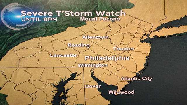
Strong To Severe Storms This Evening
A severe thunderstorm watch is in effect until 9 p.m. for the region, as a strong cold front will bring scattered showers and storms.
Watch CBS News
A severe thunderstorm watch is in effect until 9 p.m. for the region, as a strong cold front will bring scattered showers and storms.

Expect partial sunshine for Labor Day with more chances for scattered showers and storms.

After a cool and damp start to the weekend, improving conditions return for the second half of the weekend.

A slow moving frontal boundary will move through the region keeping rain chances in the forecast through the first half of the weekend.

It didn't feel like the middle of August this weekend with very low humidity levels and high temperatures slightly below average. If you enjoyed the weather, you will enjoy Monday's conditions.
Some small stream and urban flooding is possible tonight in any slow moving showers and thunderstorms.

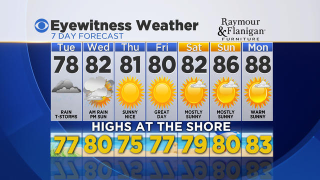
A storm system currently situated over the Midwest will impact the region with rain and thunderstorms on Tuesday

The stretch of warm and pleasant weather will come to an end this week.
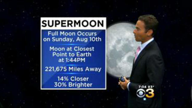
You may have noticed the moon has been looking bigger and brighter recently. A Supermoon will occur on Sunday afternoon.

The stubborn weather pattern that kept skies mostly cloudy with a few showers this weekend will begin to break for the work week.

The rest of the weekend will not be a washout, but the threat of some showers will continue in the forecast.

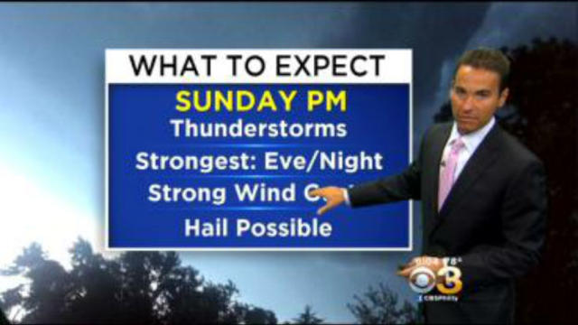
Scattered strong to possibly severe thunderstorms will continue to impact the Delaware Valley overnight.
After temperatures below average the past few days, typical late July weather returns for the rest of the weekend.
Don't get used to the pleasant temperatures because a warmer and more humid air mass will return over the next few days.

A cold front will be moving through the Delaware Valley tonight keeping the chance for some showers and storms.

A hot and humid air mass continues to build into the region from a stronger southerly wind flow. Tonight will be muggy and warm with low temperatures in the 70s.

Changes in our weather pattern will occur this week, bringing back typical July weather.

It doesn't feel like the July 4th holiday with below average temperatures and a very dry air mass in place.

After a pleasant weekend with low humidity across the Delaware Valley, a warmer and humid air mass will begin to return for the work week.

The Delaware Valley is experiencing another weekend with a pleasant air mass as a high pressure system remains in place.

It has been a nice stretch with comfortable conditions the past several days, but now the humidity makes a return.

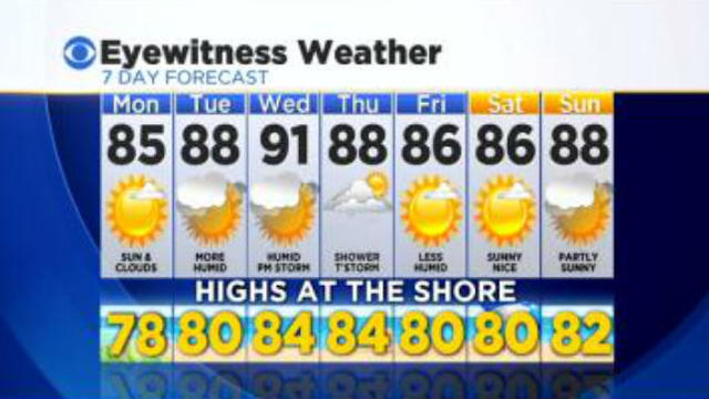
Southerly winds will return on Monday with sun & clouds with high temperatures near average in the mid 80s.

The summer solstice officially arrived this morning at 6:51, which marks the Sun's farthest point north in the northern hemisphere. This gives us our longest daylight of the year, just over 15 hours in Philadelphia.

Highs on Monday will return well above average in the upper 80s.
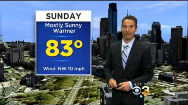
The quiet and comfortable weather will continue for Father's Day, making it a great day to spend outdoors.