Tornado watch for Philadelphia region expires after waterspout formed in Cape May County

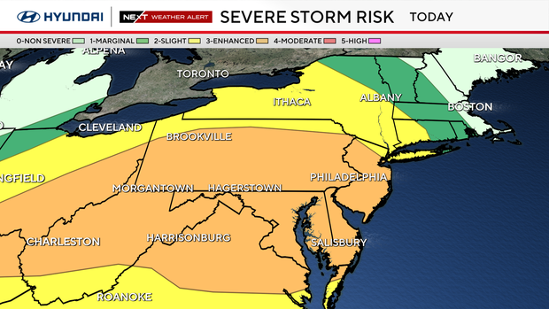
A tornado watch for the Philadelphia region expired Tuesday night after severe storms moved across the Delaware Valley.
A tornado warning in Cape May County expired at 6:45 p.m., the National Weather Service said. Tornadoes have already been confirmed in northern New Jersey.
A severe thunderstorm watch is also in effect in Kent and Sussex counties in Delaware until 10 p.m. A flash flood warning also remains in effect until 11 p.m. in Kent and New Castle counties in Delaware.
A photo sent to the National Weather Service shows a waterspout over the Delaware Bay in Cape May County Tuesday night.

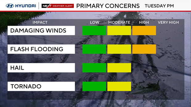
Rainfall rates of 1-2 inches per hour were possible Tuesday. Locations that see multiple storms move over the same area could experience rapid flash flooding. Urban areas, poor drainage locations and small streams will be especially vulnerable.
NEXT big weather changes
The threat shifts farther south and east on Wednesday, with additional showers and thunderstorms possible, especially across southern New Jersey and Delmarva.
A few strong storms and localized flooding remain possible, but the overall risk should be lower before drier weather returns later Wednesday and continues into the weekend.
Here's your 7-day forecast:
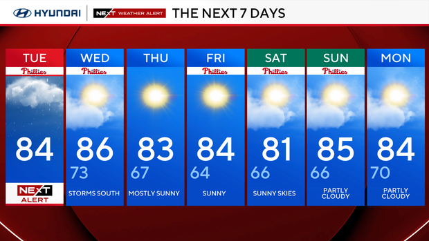
Tuesday: NEXT Weather Alert. Severe storms. High 84.
Wednesday: Storms south. High 86, low 73.
Thursday: Mostly sunny. High 83, low 67.
Friday: Sunny. High 84, low 64.
Saturday: Sunny skies. High 81, low 66.
Sunday: Partly cloudy. High 85, low 66.
Monday: Partly cloudy. High 84, low 70.


