Video shows waterspout amid tornado warning in Cape May County, New Jersey
A video sent to CBS News Philadelphia shows a waterspout over the Delaware Bay amid a tornado warning in Cape May County, New Jersey, Tuesday night.
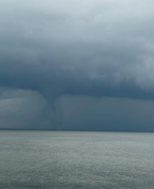
Photo shows waterspout amid tornado warning in Cape May County
The tornado warning was in effect for nearly an hour as severe storms continue to threaten the Philadelphia region.
A photo sent to the National Weather Service also shows the waterspout over the Delaware Bay.
"That picture there really shows the strength of that," NEXT Weather Chief Meteorologist Bill Kelly said. "When you look down toward where it's hitting the water, you can actually see the different colors, where the water is being lifted. So there's no doubt that funnel cloud had reached the ground in that situation. That is a textbook waterspout."
What is a waterspout?
According to the National Oceanic Atmospheric Administration, waterspouts fall into two categories: fair weather waterspouts and tornadic waterspouts.
Tornadic waterspouts are tornadoes that form over water or move from land to water. They have the same characteristics of a land tornado and are associated with severe thunderstorms. They're accompanied by high winds and seas, large hail and frequent dangerous lightning.
Fair weather waterspouts usually form along the dark flat base of a line of developing cumulus clouds, according to NOAA. This type of waterspout is generally not associated with thunderstorms.
NOAA says that while tornadic waterspouts develop downward over a thunderstorm, a fair weather waterspout develops on the surface of the water and works upward.
The fair weather waterspouts form in light wind conditions, so they normally move very little.
"If a waterspout moves onshore, the National Weather Service issues a tornado warning, as some of them can cause significant damage and injuries to people," the NOAA wrote. "Typically, fair weather waterspouts dissipate rapidly when they make landfall, and rarely penetrate far inland."