Chance of severe storms in Philadelphia region Thursday. Here's the weather forecast.

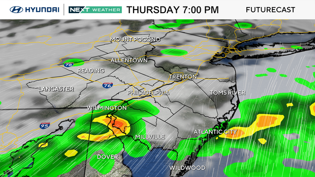
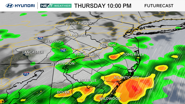
A NEXT Weather Alert will be in effect for the Philadelphia region for a chance of a few severe storms on Thursday night.
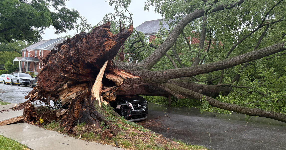
This storm will bring the chance of isolated strong to severe storms with damaging wind gusts and heavy rain. The atmospheric conditions could even produce a brief, weak tornado.
Possible impacts include travel delays, localized flooding, power outages and knocked down trees and branches.
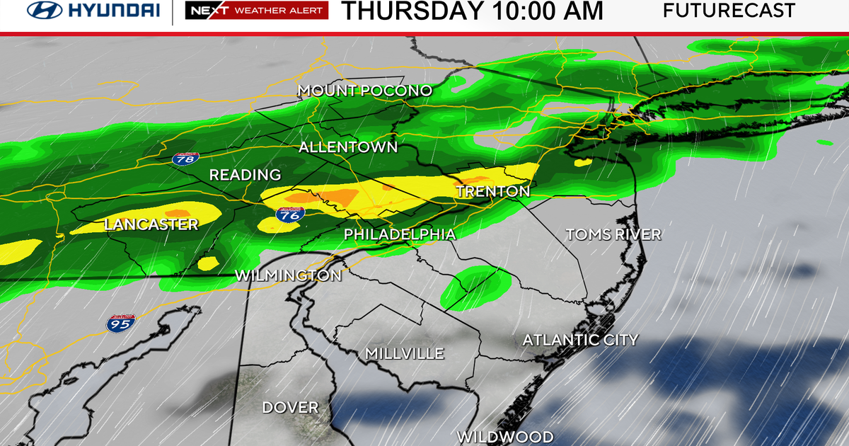
Thursday morning and afternoon weather
A warm front from a system west of the Philadelphia region lifts north of our area on Thursday, and temperatures will soar to the upper 70s. There is a chance of scattered showers throughout the day, but the severe threat for us arrives later in the evening through overnight.
The latest maps from the Storm Prediction Center have our region mostly under a "marginal" risk of severe weather or Level 1 on a five-point scale. Off to the west and southwest is an area shaded in Level 2 or "slight" risk – portions of Berks and Chester counties are included in that alert along with all of Lancaster County.
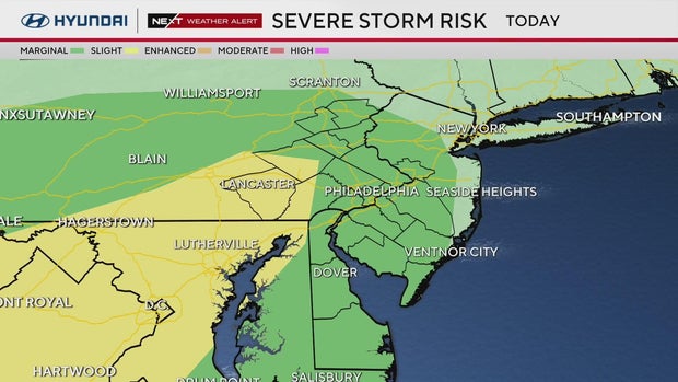
This is an indication that storms will be moving toward us but weakening as they arrive.
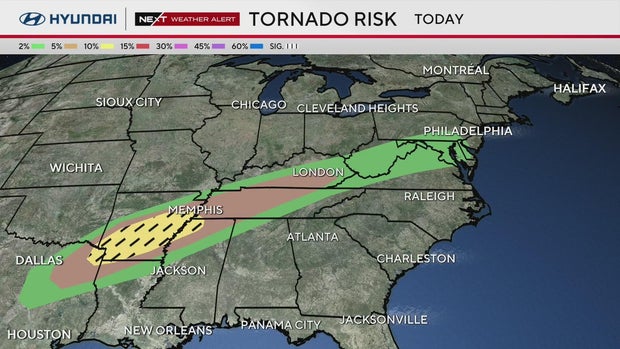
There is a pronounced tornado risk over Arkansas and small parts of Alabama and Texas on Thursday, and that risk on this map does include a very small risk in the Philadelphia area.
It's about a 2% risk, which means it's unlikely we will see a tornado, but indicates there is enough rotation in the wind field that any storm could potentially spin up a brief, isolated tornado.
Philadelphia weather heading into the weekend
On Friday, we'll likely have some lingering rain for your morning drive, but skies dry out for the afternoon and evening, ahead of another wet pattern that settles in through the weekend. Temperatures will also see-saw up and down from the 50s to the 70s.
By early next week, a push of much colder air arrives, and on Tuesday, we will struggle to reach 50 for a high, and by Wednesday morning, winds may gust to 40 mph-plus, along with temps near freezing, which will bring wind-chill values into the teens.
It is still too soon to put away the winter gear. Isn't spring fun?
Here's your 7-day forecast
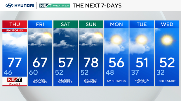
Thursday: NEXT Weather Alert for p.m. storms. High of 77, low of 46.
Friday: Clouds, showers. High of 67, low of 60.
Saturday: Clouds, showers. High of 57, low of 52.
Sunday: Warmer, shower. High of 78, low of 52.
Monday: A.m. showers. High of 56, low of 48.
Tuesday: Cooler and windy. High of 51, low of 37.
Wednesday: Cold start. High of 52, low of 32.
Get the latest weather info on the CBS News Philadelphia app.