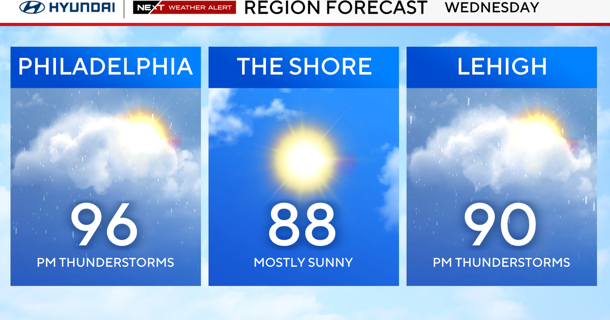
Fall-like conditions continue Wednesday in Philadelphia region. Here's the weather forecast.

An early taste of fall will remain in the air as temperatures on Wednesday morning in the Philadelphia region start in the low 50s to near 60 degrees, which will be the coolest for many since the middle of June.
It will also be closer to the normal lows in mid-late September, not late August. Skies will be mostly sunny aside from a few clouds in the early morning.
In addition, the air will be humidity-free (at least how we as humans feel it), which will provide for a decent temperature spread between the lows and the highs. Temps will top out in the mid-upper 70s, while the normal high in Philly for Aug. 27 is 85 degrees.

This cool trend means we may have three to four days with morning low temperatures in the 50s by the end of August. We haven't had that many since 2004, when four days had lows of 59 or lower. Prior to that, it was back in 1994. Lows in the 50s in August don't occur very often.
A few added clouds are expected on Thursday, and then a second reinforcing shot of cool air arrives Friday, bringing our temperatures down further for the Labor Day holiday weekend. Highs from Saturday to Monday will warm from the mid-70s to near 80 degrees, with morning lows in the mid to upper 50s.
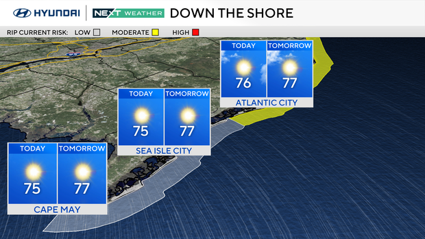
If you will be at the Shore, the rip current risk will stay low to moderate for the next couple days.
The front on Thursday evening and into Friday may bring a stray shower or two, but no significantly impactful weather is expected, which is both good and bad. It's good that the conditions will be great for anything you want to do outside, however, we are getting to the point in which we really need to start talking about getting some rain.
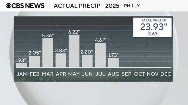
So far we've only had 1.73 inches of rain in August, and 1.43 inches of that occurred on Aug. 17 alone. It was around this time last year that our extreme drought began. We had 0.78 of an inch on Aug. 18, 2024, and then only had 1.08 inches for the next two months. It took until earlier this summer to pull out of the drought, and the current drought monitor now has areas of "abnormally dry" dotting the landscape.
It's hard to believe Labor Day weekend is this Saturday and Sunday. Labor Day itself is on Monday, which is the actual start of meteorological fall.
If you are not ready for summer to end, don't worry, because the official start of fall is still four weeks away on Monday, Sept. 22.
Here's your 7-day forecast:
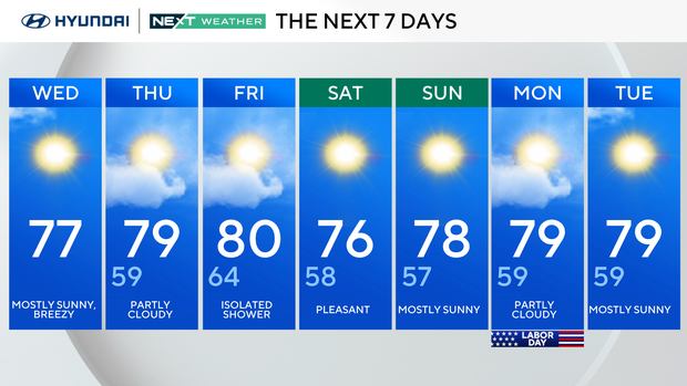
Wednesday: Sunny and mild. High 78, Low 59.
Thursday: Partly cloudy. High 79, Low 59.
Friday: Partly cloudy. High 80, Low 64.
Saturday: Sunny skies. High 76, Low 58.
Sunday: Sunny skies. High 78, Low 57.
Monday: Partly cloudy. High 79, Low 59.
Tuesday: Mostly sunny. High 79, Low 59.