Philadelphia temperatures stay mild a little longer, chance of rain Thursday
Light rain in the Philadelphia region on Thursday morning will give way to steadier precipitation in the mid-morning hours that lingers through lunchtime.
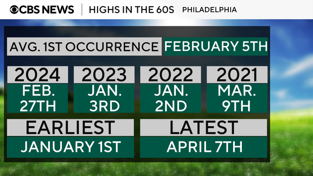
Regarding the temperature, Thursday is a bit of a transition day. After Wednesday marked the first day of the year with a high above 60 (we reached 61 degrees), the region is going to cool down on the back end of Thursday's rain.
February ends on Friday with a quiet and more seasonable day with a high of around 51 degrees.
March may come in more like a lamb than a lion on Saturday with highs in the mid-50s again (possibly pushing 60?), but a cold front will arrive at night.
It's Sunday, the second day of meteorological spring, that may be more lion-like with highs only in the mid 30s and feels-like temps staying well below freezing — basically a 30-degree drop in temps when accounting for wind chill from Saturday to Sunday.
Needless to say, Saturday will be the better day to get stuff done outdoors. Both days, however, will be quite breezy.
At this point the March chill only looks to last a few days as our temps should be back into the low 50s by Tuesday and back into the mid-60s on Wednesday!
In addition, the forecast models are pointing to a fairly strong weather system that could bring storms as well as some moderate rain. We'll have to keep our eyes on that one as we start to transition from winter forecasting to the possibility of strong to severe storms. The NEXT Weather team will keep you posted!
Here's the 7-day forecast:
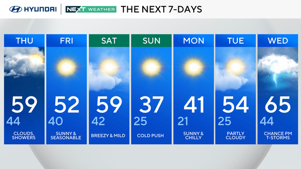
Thursday: Clouds, showers. High 59, low 44.
Friday: Sunny and seasonable. High 52, low 40.
Saturday: Breezy and mild. High 59, low 42.
Sunday: Cold push. High 37, low 25.
Monday: Sunny and chilly. High 41, low 21.
Tuesday: Partly cloudy. High 54, low 25.
Wednesday: Chance of p.m. thunderstorms. High 65, low 44.
Get the latest weather info on the CBS News Philadelphia app.