Strong storms possible in Philadelphia region as heat wave ends

We survived several record-breaking days with excessive heat in the Philadelphia region, including the first day with temperatures above 100 degrees in nearly 13 years.
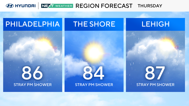
As we've turned the corner, temperatures are returning to a more reasonable range for this time of the year. Expect temperatures to return to the mid-to-upper 80s for many locations around the Delaware Valley today.
From the heat to the threat of severe storms
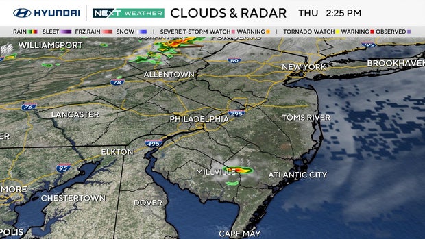
The National Weather Service has issued a severe thunderstorm watch until 10 p.m. for much of the region, but that has been lifted for Philadelphia. The watch is still in effect in Delaware and part of Delaware County.
Only a few isolated storms have developed in South Jersey and in the Poconos, but more will fill in over the next couple of hours, which will bring the threat of strong and gusty winds, lightning and heavy rain.
There is also a flood watch in effect for Bucks, Chester and Lehigh counties until midnight. Additionally, the area will be a little more susceptible to heavy rainfall and the threat for flash flooding.
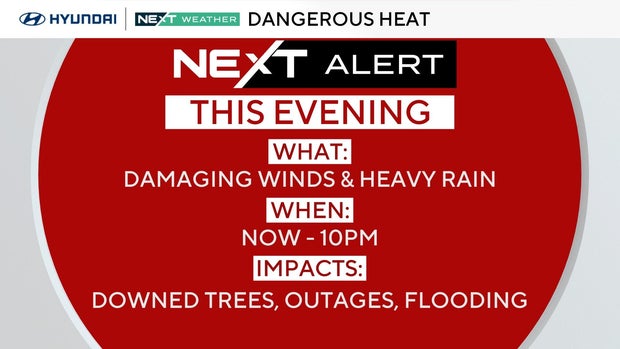
Because of the potential for severe storms, a NEXT Weather Alert has been issued through 10 p.m.
Here's your 7-day forecast:
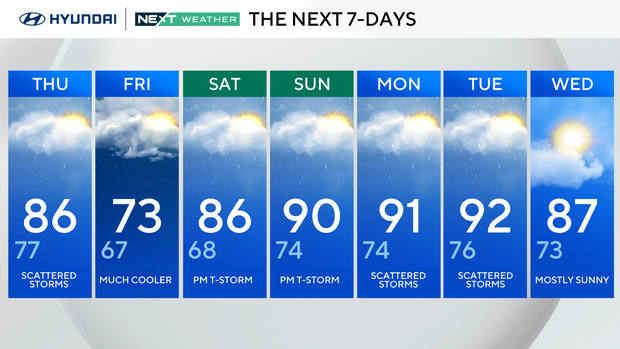
Thursday: Scattered storms. High 86, Low 77.
Friday: Much cooler. High 73, Low 67.
Saturday: P.m. thunderstorm. High 86, Low 68.
Sunday: P.m. thunderstorm. High 90, Low 74.
Monday: Scattered storms. High 91, Low 74.
Tuesday: Scattered storms. High 92, Low 76.
Wednesday: Mostly sunny. High 87, Low 73.


