Isolated showers possible Friday in Philadelphia area; hot, dry weekend ahead. Here's the weather forecast.
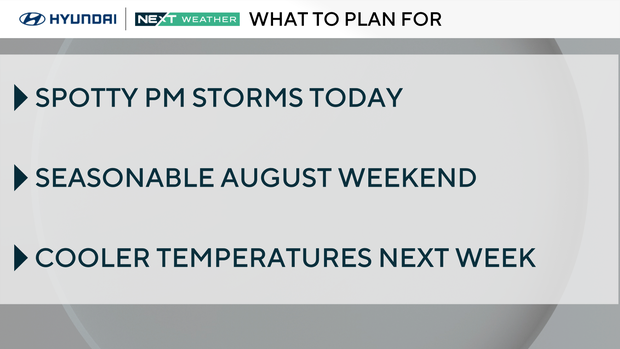
It's a seasonably hot and humid August day, but an easterly breeze will drop the dewpoints ever so slightly on Friday afternoon. That sea breeze could be responsible for sparking a few spotty storms, mainly from the city to the west this afternoon.
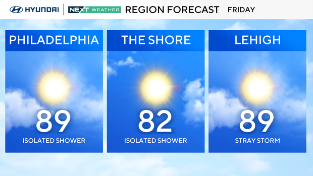
No severe weather expected, but a rumble of thunder isn't out of the question, so be on the lookout if spending any time outside Friday afternoon and early evening.
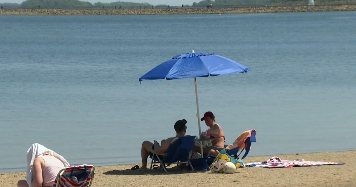
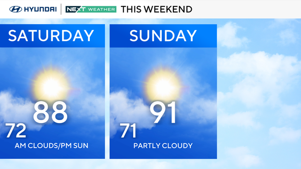
The weekend will dry out for the most part, and temperatures will remain near 90 degrees. If you are someone who enjoys the hot, dry summer days, then we encourage you to make your plans and soak in these conditions.
Labor Day weekend is only two weeks away, meaning weekends like the one upcoming will be few and far between from here on out. Of course, fall is right around the corner, and that's awesome, but it's not the best for enjoying the pool, water parks, beaches, etc.
Sunday may likely be the hottest day with temps in the mid-low-90s, but there's no sign of any extended streaks of extreme heat.
Your NEXT Weather team continues to closely monitor Hurricane Erin. Erin strengthened into a hurricane Friday as the storm continued on a path over the Atlantic Ocean, forecasters said. It is the first hurricane to develop in the Atlantic this year, and it was expected to continue gaining strength, potentially growing into a major hurricane.
Your NEXT Weather team will continue to update as we get more information.
Here's your 7-day forecast:
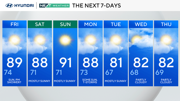
Friday: Sun, p.m. shower? High 89, Low 74
Saturday: Mostly sunny. High 88, Low 71
Sunday: Mostly sunny. High 91, Low 71
Monday: Some sun, T-storm chance. High 88, Low 73
Tuesday: Mostly sunny. High 81, Low 67
Wednesday: Partly cloudy. High 82, Low 68
Thursday: Partly cloudy. High 82, Low 69