Storms return to NYC, New Jersey, cause damage in parts of area
Some storms returned to the New York City and New Jersey area on Friday.
Communities in both states have been on edge about the severe weather threat, which comes days after storms inundated neighborhoods and even caused the roof of a BJ's Wholesale Club to collapse in Ocean Township, New Jersey.
Check the latest weather watches, warnings and advisories related to the storms.
"We are anticipating some scattered, potentially heavy, thunderstorms this afternoon with potential to produce damaging winds. Please drive with caution, avoid flooded areas, and stay alert for any weather warnings in your area," N.J. Gov. Mikie Sherill posted on social media.
In Manalapan Township, New Jersey, there was a report of a large tree falling onto a house.
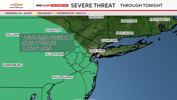
Friday storm threat
Compared to Thursday, Friday has been a much calmer day, however the threat of storms is still out there.
There have already been a few thunderstorms across the region, one of which has been severe.
As the evening progresses into the early portion of the night, isolated strong to severe storms are possible, especially south and west of the city.
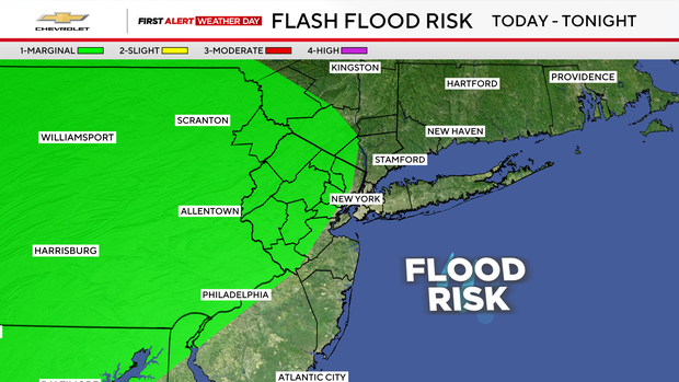
The main threat associated with these storms would be damaging winds and torrential downpours that could lead to flash flooding. A repeat performance of what occurred on Thursday does not look likely though.
The severe threat should diminish overnight, with an isolated shower or two. Lows will range from the mid 60s to low 70s, with cloudy and muggy conditions.
Weekend forecast
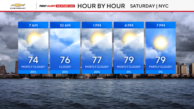
Heading into Saturday, the chance of showers and storms does return, mainly from the late morning through the early evening hours. While the severe threat isn't as pronounced as it has been lately, an isolated strong storm may develop.
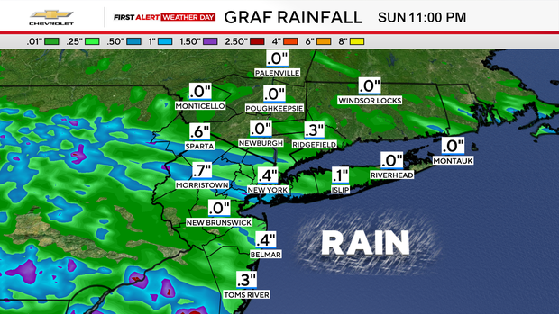
Rainfall totals will vary greatly from town to town, with some locales receiving nothing and others receiving over an inch.
The clouds and scattered storms will keep temperatures from getting too high, only reaching the low to mid 80s at best. Clearing skies will then be in place for Saturday night.
This will set us up for a gem of a day on Sunday, featuring lots of sunshine, lower humidity, and highs in the mid 80s.


