Winter turns brutal as dangerous cold settles in across Tri-State Area

Dangerous cold is gripping the region, with feels-like temperatures across the Tri-State Area dipping into the negatives.
Tuesday was the coldest day of the winter so far, and the CBS News New York Weather Team has declared a First Alert Weather Day through Wednesday morning due to the dangerously cold temperatures and windchills.
Temperatures rebound for middle of week
An arctic airmass has had a firm grip on the Tri-State Area since Monday night. With clear skies in place, temperatures will drop even lower tonight.
The snow on the ground will certainly assist with lows getting into the single digits and even below zero across many of the suburbs. Coastal areas and the city will drop into the lower teens.
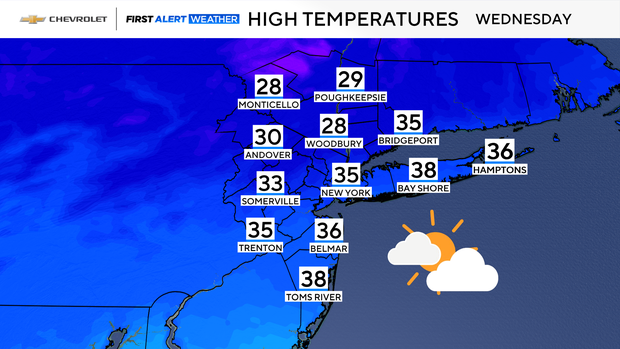
After a frigid start, temperatures should rebound nicely later on Wednesday, reaching the mid to upper 30s. A few snow or rain showers are possible late in the day as well.
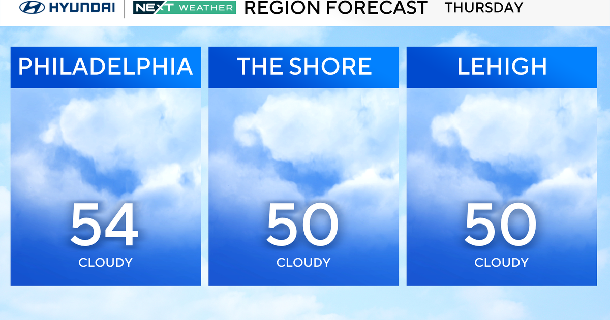
Temperatures then briefly spike into the mid 40s on Thursday before plunging once again by Friday.
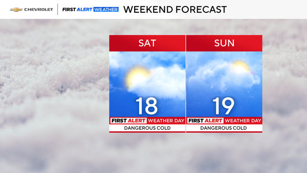
Cold weekend with a snow chance
All eyes are on the weekend, as yet another winter storm will threaten the region. We are very confident that an arctic airmass will be firmly entrenched across the Northeast this weekend. That airmass will be colder than the one we're currently in and will feature high temperatures in the teens.
Confidence has been steadily increasing that a potent coastal storm will develop offshore of the Mid-Atlantic Coastline from Sunday into Monday. As that storm tries to advance northward into our region, we are also quite confident that precipitation would be all in the form of snow, given how cold temperatures will be. Where confidence is lacking however, is the track of the storm, which is contingent upon the placement of an area of arctic high pressure. As of now, our two main forecast models are serving up different scenarios.
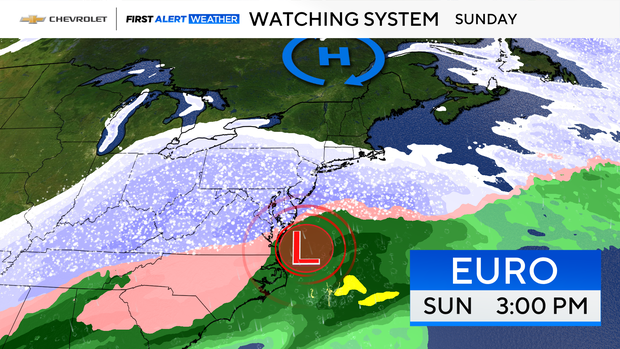
As per the European model, it suggests that arctic high pressure will set itself up in central Quebec, therefore allowing the coastal storm to move further northward. In that scenario, our entire region would see a range of 9-15 inches of snow.
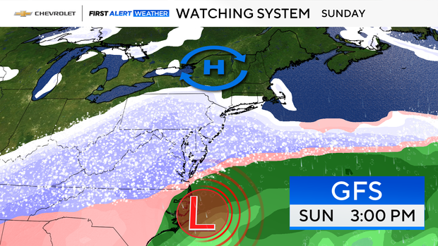
On the other hand, the American model, also known as the GFS, places the arctic high pressure in central New York state, hence, suppressing the coastal storm to the south. That outcome would be entirely different, with snowfall totals only amounting to a range of 2-6 inches.
The models are likely to continue flip-flopping on snow totals for the rest of the week. By Friday, we'll be able to forecast this potential snowstorm with a lot more certainty.
Northern Lights in New York tonight
After signs of the Northern Lights last night, don't expect a repeat performance tonight.
It looks like the southern extent of the view line will only make it to the U.S./Canadian border off to our north. So, the odds of having a visual around here are low.