Cold, rainy weather in NYC continues before drying out for the weekend
Heavy rain and cold temperatures continue to impact the New York City area.
Friday is another First Alert Weather Day for rain, isolated severe thunderstorms, localized flooding, mountain snow and winter-like temperatures.
It's cold and windy, with temperatures expected to peak in the 40s during the day before dropping to the 30s at night. Winds will make it feel more like the 30s.
Snow could also develop across higher elevations of the Catskills and other areas above 1,500 feet.
Rain will gradually taper to drizzle during Friday night, with light rain expected during the evening commute.
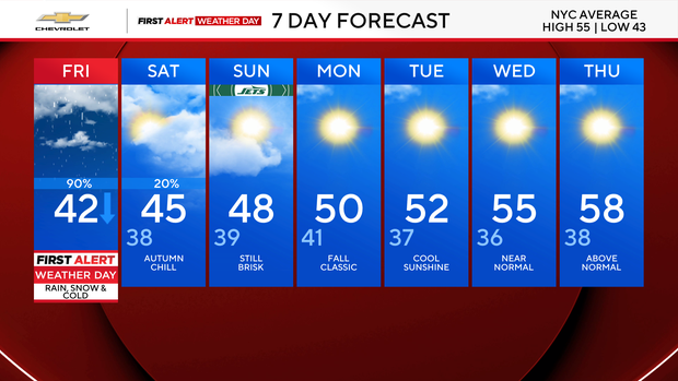
The weekend looks quieter but noticeably colder, with breezy conditions and highs mainly in the mid-40s to around 50 degrees.
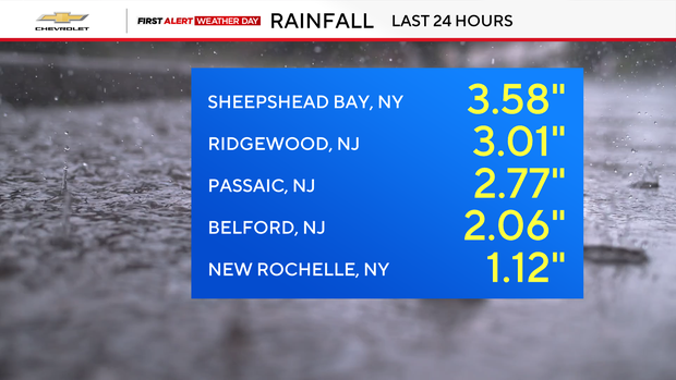
Rain pounded the Tri-State Area Thursday, with Sheepshead Bay getting the most rain, measuring 3.58 inches
Tornado warnings were also issued for parts of New Jersey and Queens.
The tornado warning was radar-indicated, which means so far there's been no confirmation of a tornado actually touching the ground.
Hail was also reported.
Click here to check the latest weather warnings, watches and alerts.