New York weather includes heavy rain, strong storms and potential snow in some areas
A storm system is bringing all kinds of weather conditions to the New York-area, including heavy rain and potentially strong storms and snow.
The weather could also impact the search and rescue efforts underway in Brooklyn after a building collapsed Wednesday.
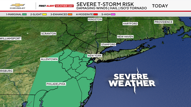
A First Alert Weather Day is in effect Thursday and Friday for rain, isolated severe thunderstorms, localized flooding, mountain snow and winter-like temperatures
Thursday starts on a relatively quiet note, with a few showers mainly across northwestern parts of the region and some clouds and temperatures in the 50s in New York City.
By lunchtime, scattered showers will become more widespread as moisture advances into the area.
The weather becomes more impactful during the afternoon and evening commute. Periods of heavy rain are expected, along with the potential for isolated severe thunderstorms.
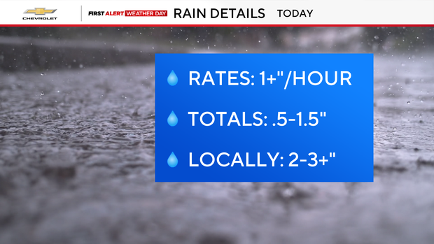
Some of the strongest storms could produce downpours with rainfall rates exceeding 1 inch per hour. Storm totals of 0.5 to 1.5 inches are likely across much of the area. Isolated locations could see 2 to 3 inches or more, raising concerns for localized flooding and ponding on roads.
Rain continues tonight, while colder air settles in. That could allow snow to develop across higher elevations of the Catskills and other areas above 1,500 feet.
The unsettled weather lingers Friday, which will be another First Alert Weather Day. Rain will gradually taper to drizzle during the afternoon, while snow showers continue across the higher terrain to the north and west.
Temperatures will peak early in the day in the 40s before falling steadily, with winds making it feel more like the 30s.
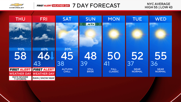
The weekend looks quieter but noticeably colder, with breezy conditions and highs mainly in the mid-40s to around 50 degrees.