Rainy weather with possibly strong storms return to New York, New Jersey area this week
After a beautiful stretch of weather, conditions will go downhill with rain and potentially strong storms on deck for the New York area this week.
Monday was a nice but humid day with highs reaching into the low to mid 80s. As the humidity levels climb, it sets the stage for periods of heavy rain and thunderstorms throughout most of the week.
Tuesday and Wednesday are First Alert Weather Days for downpours and thunderstorms. The National Weather Service has issued a Flood Watch from 8 a.m. Tuesday through 8 p.m. Wednesday.
There are also dangerous rip currents from 6 a.m. to 9 p.m. Tuesday for beaches south of the city and on Long Island.
Rounds of heavy rain Tuesday and Wednesday
Once Tuesday rolls around, the rain and storm chance, along with humidity levels, will increase. It is likely to be the most active day of the week, with rounds of very heavy rain and thunderstorms.
Unlike last week, when all severe hazards were on the table, this Tuesday's greatest hazard from thunderstorms will be torrential downpours that may lead to flash flooding.
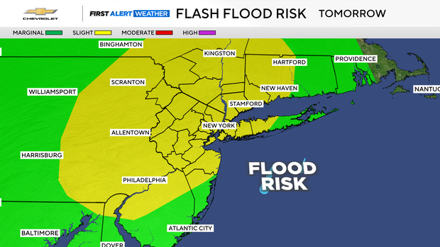
Damaging winds and hail are still possible too, with the greatest chance of those occurring well to the south and west of the city. It's possible rain could fall at two to three inches per hour at times.
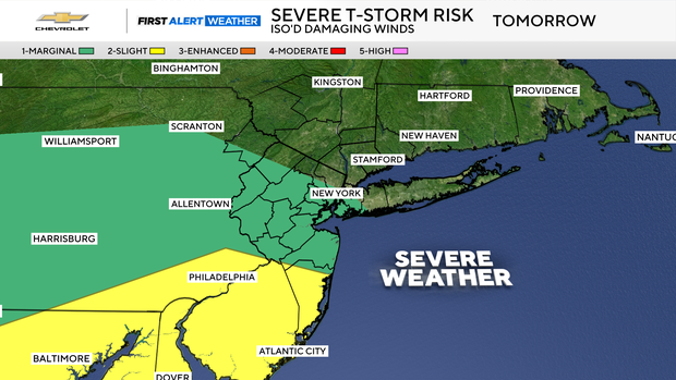
The heavy rain threat continues Wednesday but doesn't look as prolific or widespread. Overall, rainfall this upcoming week is likely to total between two to four inches across the Tri-State Area, with locally higher totals possible.
Temperatures will run below normal, ranging from the upper 70s to low 80s, and it will feel tropical at times. Haze from Canadian wildfires will drift in and out as well.
Better weekend weather
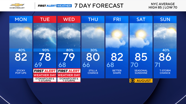
Things are looking up for the weekend with Friday and Saturday looking dry.


