Heavy rain, flash flood threat return to NYC area Sunday. Get the First Alert Weather Day forecast.
Rainy weather returns to the New York City area Sunday, bringing with it the threat of flooding.
A First Alert Weather Day has been issued for later on Sunday due to the threat of downpours could cause localized flooding, especially southwest of New York City.
It was a beautiful Saturday with mostly sunny skies, low humidity and temps in the low to mid 80s.
Things stay quiet overnight under partly cloudy skies. Humidity will be on the rise as a southerly flow kicks in. Lows will be in the 60s for most and upper 50s in the distant northwest suburbs.
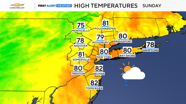
The area remains dry through Sunday morning with just increasing clouds. Skies turn cloudy into the afternoon, and showers start to move in from the southwest by about 3 p.m. onward. No real issues through sunset with just light to moderate showers around. Highs Sunday will be in the upper 70s to low 80s with a muggy feel.
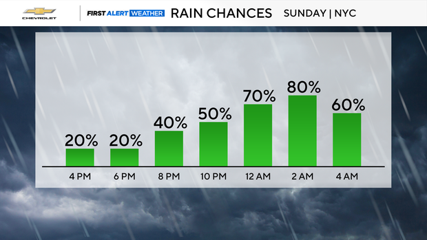
Into Sunday night and especially during the overnight period, some heavier downpours will be possible. While not everyone will see the heavy rain, where downpours do occur could cause localized flooding. The trends today have been south as far as the best risk of these heavier pockets.
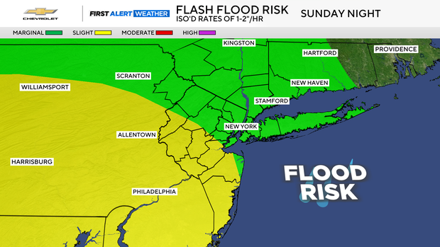
The First Alert period is Sunday night after sunset, through about 4 a.m. Monday. We can't rule out an isolated strong thunderstorm, but the severe risk with this remains low as of now. Rainfall totals will likely be .5 to 1.5" with localized higher amounts. This will not be a widespread heavy rain event, but the risk for heavier cells is there.
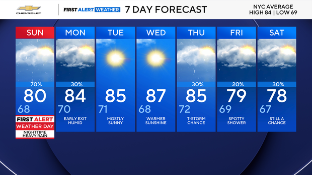
It continues to look like a quick exit Monday morning with just a lingering shower early on, then brighter skies into the afternoon. A hit or miss shower/storm Monday afternoon is possible but should be fairly isolated.


