Rain, snow, then extreme cold the next few days around NYC
NEW YORK -- The weather starts to warm up Friday around New York City, but rain, snow and dangerously cold temperatures are on the way over the next few days.
Rain and snow are expected to arrive this weekend, followed by the coldest air so far this season early next week.
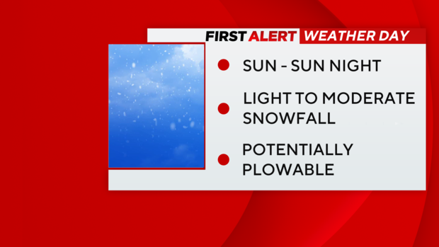
We've issued a First Alert Weather Day for Sunday, due to the threat of several inches of snow. Then again Tuesday and Wednesday for the cold temperatures.
Sunny and slightly warmer around NYC today
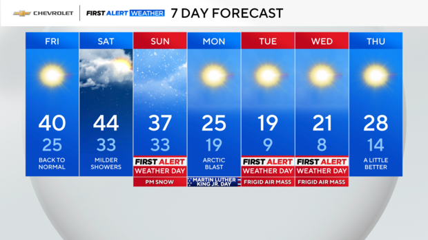
We've got a January gem in store, but the trend is downhill from here. We're calling today the "Pick of the Week" runner-up, with lots of sunshine and temperatures closer to normal. Enjoy!
Tonight will be quiet, albeit chilly, so you'll easily enjoy those evening plans.
Saturday rain showers
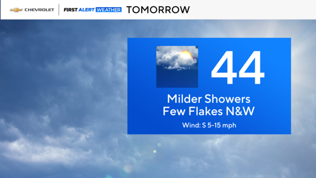
Tomorrow's looking a little dicey with some showers around. While it doesn't appear to be a washout, you'll need to keep the umbrella handy.
Worth mentioning, if you're heading up toward the Catskills, don't be surprised if you encounter some snow showers.
Snow in the forecast Sunday
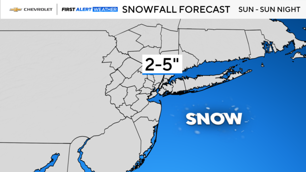
Then, our attention turns toward Sunday. It looks like precipitation will overspread the area in the afternoon, falling mainly in the form of snow.
It will be light to moderate through the evening, then taper off later in the evening and overnight. When all is said and done, up to several inches of snow are expected.
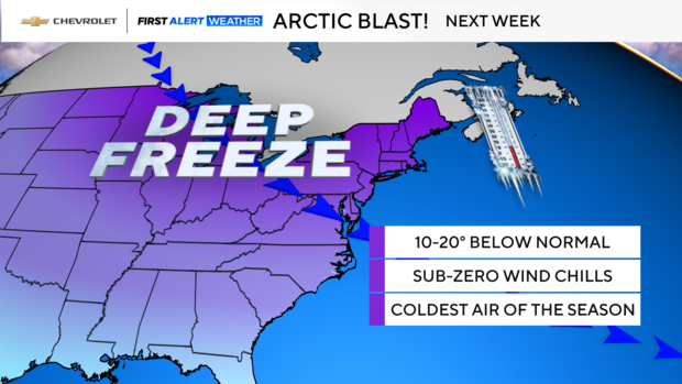
After that, the coldest air of the season invades the Tri-State — brrr!
Check back for updates on Sunday's snow and the big chill.
Live radar around Tri-State Area
Stick with our First Alert Weather team for the latest forecast, live radar and weather alerts.