Severe weather sparks tornadoes, flooding across Tri-State Area. Get the First Alert Forecast.

Severe weather impacted the entire region on Tuesday, with watches and warnings throughout the CBS News New York viewing area.
It was a First Alert Weather Day due to the numerous threats, coupled with heavy downpours, strong winds and flash flooding.
Heavy downpours plagued New York City's northern and western suburbs and tornado warnings popped up in upstate Sullivan County and in Morris, Sussex and Ocean counties in New Jersey.
The First Alert Weather Team confirmed a tornado touched down in the area of Stanhope on the Morris and Sussex border, near I-80 and US 206. Trees and wires were said to be down in the area. Another tornado touched down in Parsippany-Troy Hills in Morris County.
How much rain did we get?
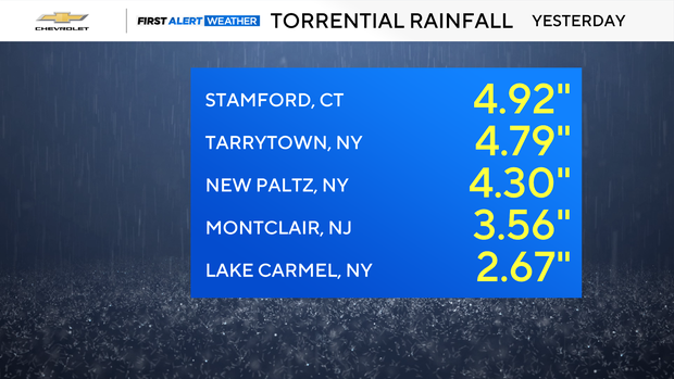
Stamford, Connecticut and communities in New York's northern suburbs had the most rain for the area.
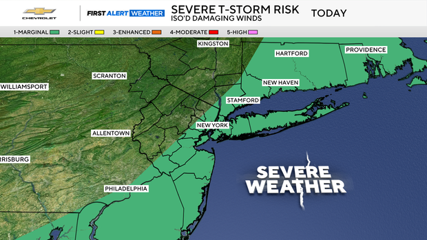
Is it supposed to rain today?
Wednesday, there will be scattered storms in the early afternoon as the cold front finally moves through. Some storms could be strong, especially on Long Island and the Jersey Shore.
Humidity will be dropping later in the day with temperatures in the 80s.
Weekend weather looking good
Once the wet weather passes, the rest of the week looks dry with lower humidity. Temperature-wise, highs will generally be in the lower 80s this week, which is below average for late July.
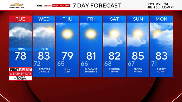
Clouds will gradually increase at night, but we stay dry. Lows will be in the 60s in the suburbs to around 70 in the city.


