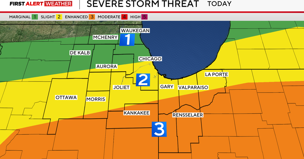
Storms cause damage, flash flooding across Tri-State Area
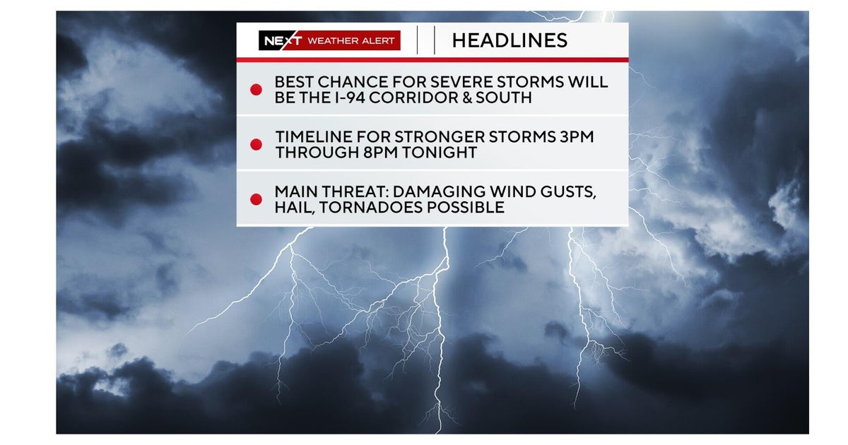
Storms came in fast and furious across the Tri-State Area on Wednesday afternoon and evening, and they proved to be destructive.
Not only did they bring down trees and powerlines, with gusts over 60 mph, they also caused some flash flooding that led to a few water rescues. A few damaging lighting strikes were reported as well.

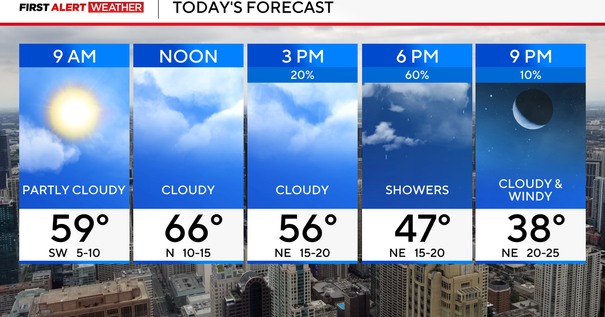
The stormy conditions came to an end by Wednesday night. A leftover shower or two is possible overnight, otherwise skies will remain mostly cloudy. It will also be quite muggy, with lows in the upper 60s to low 70s.
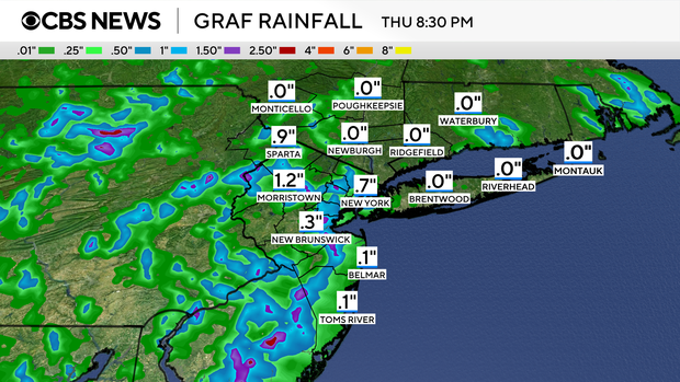
More storms possible Thursday afternoon, evening
Mostly cloudy conditions will linger into Thursday morning, as do the high humidity levels.
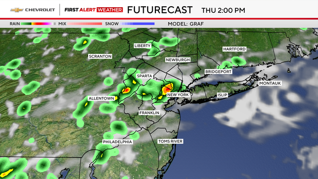
By the afternoon hours, a few peeks of sun may trigger another round of thunderstorms that could last into the early evening.
Unlike Wednesday, they look to be more isolated in coverage, and not as severe. Many areas may not even see a drop of rain, but where storms do form, they will be capable of putting down very heavy rainfall in a short amount of time.
Highs will top out in the mid to upper 80s.
Tropical Storm Erin forecast: How will it impact NYC?
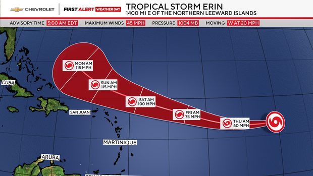
Tropical Storm Erin is projected to become the first Atlantic hurricane of the season by Thursday night, and a major hurricane by this weekend. Fortunately, there's no imminent threat to the U.S. mainland, but it will need to be monitored through next week.