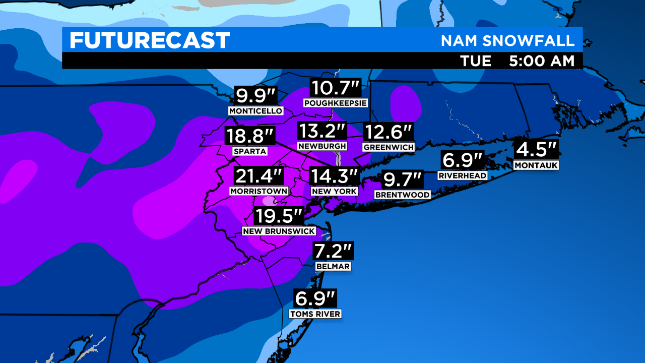
SNOW TIMELINE: At Least 6 To 12 Inches For Bulk Of Tri-State, 18-24 Possible Northwest Of NYC
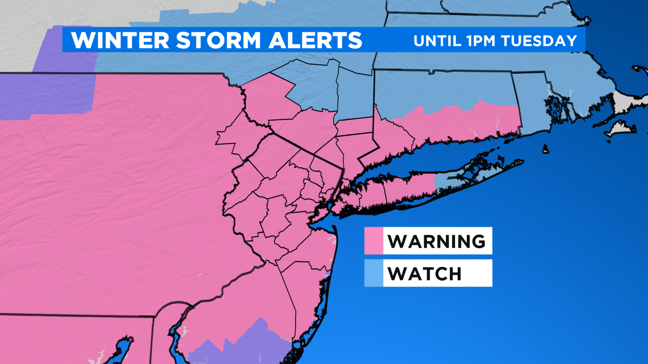
NEW YORK (CBSNewYork) -- A major nor'easter is expected to hit the Tri-State Area on Sunday evening and linger through early Tuesday.
Expect changes, because even a subtle track shift could make a big difference with snow totals.
LINK: Check The Latest Forecast
Here is an updated look at the storm's timeline:
Sunday evening - 6 a.m. Monday: Snow starts to fill in southern New Jersey up through Monmouth County.
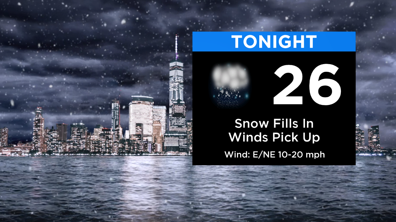
Snow showers are possible in New York City by sunset, but the steadiest snowfall holds off until later in the evening.
Temperatures will sink into the 20s overnight and the wind will pick up, too.
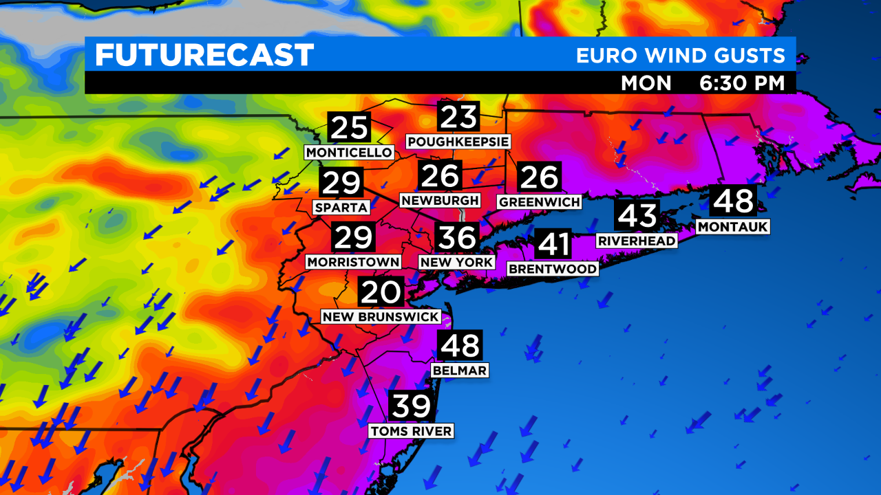
6 a.m. - 6 p.m. Monday: The brunt of the storm blossoms north and in New York City, and however far the storm pushes north those areas will get heavier snow. Winds will be gusting 40-45 mph in the city to 50-plus mph along the coasts. Coastal issues could arise.
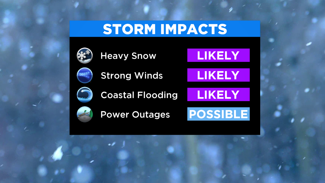
Snow could fall at heavy rates of 1- to 2-inches per hour at times, leading to near whiteout conditions. Travel will be exceptionally difficult, if not impossible.
6 p.m. Monday - 6 a.m. Tuesday: There will be a few inches of snow on the ground Monday morning, but the brunt of the storm is expected in the afternoon. It could linger into early Tuesday morning with gusty winds and stronger snow bands.
6 a.m. Tuesday: Lingering snow showers taper off through the day.
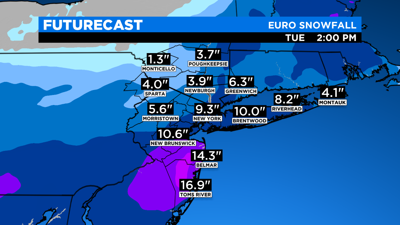
So how much snow should you expect by the time the storm moves out?
Most of the Tri-State Area will see 6-12 inches, but there is a pocket just northwest of New York City where up to 2 feet is possible.
MORE STORM INFORMATION FROM NYC:
- Guidance on restaurant preparations
- Severe weather guidance
- Department of Sanitation snow operations
- Track NYC snow plows
MORE FROM CBS NEW YORK:


