Great weekend for leaf peeping in parts of Tri-State Area. Get the First Alert Forecast.
The weekend is shaping up to be pretty decent, albeit on the cool side. Highs both days will range in the mid to upper 50s, with a mix of sun and clouds.
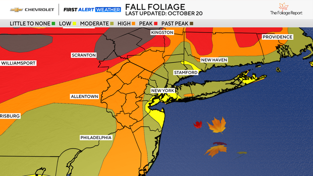
Fall foliage is really starting to peak for portions of the Tri-State Area, and it will be a great weekend to view it.
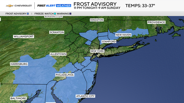
Overnight frost advisories
For tonight, temperatures are anticipated to fall into the 30s and 40s across the region under partly to mostly cloudy skies. Frost is possible once again, especially in the Hudson Valley and central New Jersey.
Frost Advisories are in place from 11 p.m. Saturday through 9 a.m. Sunday for Middlesex, Monmouth, Ocean, Fairfield, Putnam, Orange, northwestern Passaic, northern Westchester and Orange counties.
Sunday looks to be very similar to Saturday, with mostly sunny skies to start, followed by partly to mostly cloudy skies by the afternoon hours. Highs will range from the mid to upper 50s.
First Alert Weather Day issued for Thursday
A dry and cool pattern will be in place through Tuesday afternoon.
By later in the day on Wednesday, a storm may begin to affect the region. Right now, our two most reliable forecast models have come into better agreement that a storm is likely.
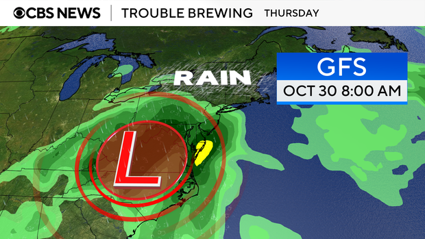
The only difference between the models is timing. The European model wants to bring the system in late Wednesday night, while the American model (GFS), wants to delay the system's arrival until Thursday morning.
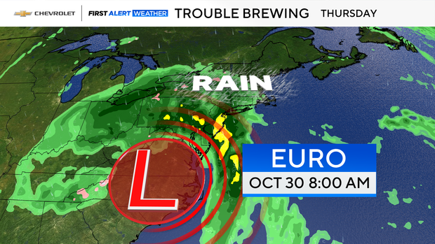
Either way, both models indicate that a strong storm, containing heavy rain, powerful winds, and coastal flooding, will affect the entire Tri-State Area later next week.
That is why we have issued a First Alert Weather Day for Thursday. Details will be fine-tuned as we get closer to the event.

Halloween outlook
Although Thursday is looking quite ghastly, Halloween's forecast is mostly dry. A few leftover showers are possible early in the day, but they should be long gone once the trick-or-treaters hit the pavement.
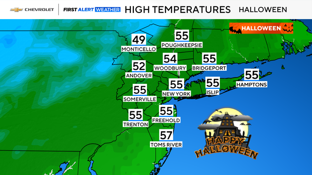
A gusty breeze will linger through the day as well. It also looks to be much cooler than last year, when the high was 81 degrees, which tied the daily record for warmest Halloween ever. Highs this Halloween will struggle get higher than the mid 50s, making it the coolest Halloween in recent years.


