More flooding concerns for NYC, parts of N.J. as rainy weather soaks Tri-State Area
New York City and parts of New Jersey were under a flood watch due to downpours and strong storms Monday.
The area was under a Flash Flood Warning until 10:45 a.m. A Flood Watch was in place for New York City, along with northern and central portions of New Jersey through 8 p.m. Monday.
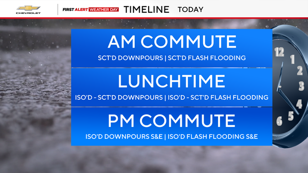
It was a First Alert Weather Day due to thunderstorms and the flooding threat.
A humid airmass in place caused prolific rates of rainfall, one to three inches per hour, at times.
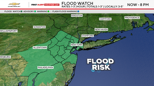
The New York City Emergency Management Department activated the city's Flash Flood Emergency Plan on Sunday. The plan includes advanced inspection and clearing of catch basins in flood-prone areas. Task forces are also on alert to respond to fallen trees and stranded vehicles.
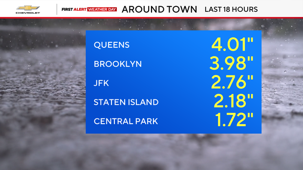
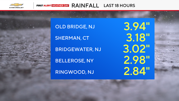
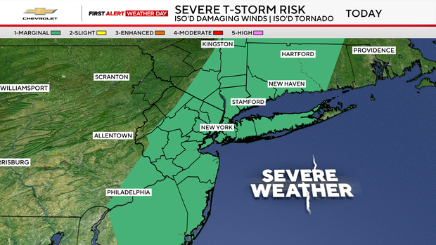
Severe thunderstorms were possible as well. The greatest hazards associated with any storms that develop would be torrential downpours and damaging winds.
A High Surf Advisory has been issued Monday for beaches south of New York City and on Long Island. Waves could reach between six and 10 feet. A High Rip Current Risk is also in effect for those beaches Monday.
Highs on Monday will reach the low 80s in most locations as clouds remain over the area.
By Monday night, the rain and storm threat came to an end. That lays the foundation for a beautiful day on Tuesday, featuring more sunshine and a slight drop in humidity levels.
Storm chances and high humidity levels will then climb again for the rest of the week.


