First Alert Weather: Stunning Saturday 9/10 Forecast
By Matt DeLucia, CBS2 Meteorologist/Weather Producer
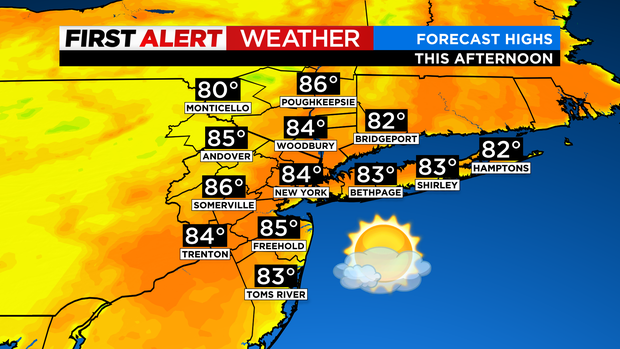
It's a 50/50 weekend with the better half being today! Expect another nice afternoon with bright skies and just some high clouds streaming in. Highs will be a touch warmer, topping out in the mid 80s.
While it's a great beach day, please be mindful that a high risk of rip currents continues today. There's also a high surf advisory for Long Island as waves up to 5-6 feet are possible. Use caution, especially since many lifeguards are already done for the season.

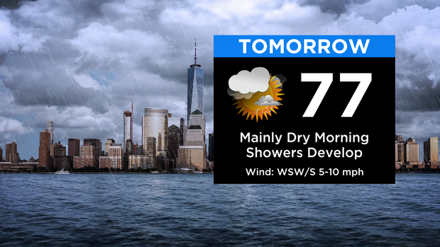
Clouds continue to build tonight, but it stays dry. Temps won't be quite as cool, falling into the 60s. Clouds will rule on Sunday, but the morning hours will be mainly dry. Into the afternoon, showers will develop from the west. Coverage then increases even more into the evening and overnight hours. Definitely grab the umbrella if you're headed out Sunday night! It's a cooler day with highs in the 70s.
Monday starts out with some leftover showers before a bit of a break for the midday hours. Showers and some rumbles then return for late afternoon and especially the evening ahead of a cold front. It stays on the unsettled side into Tuesday.