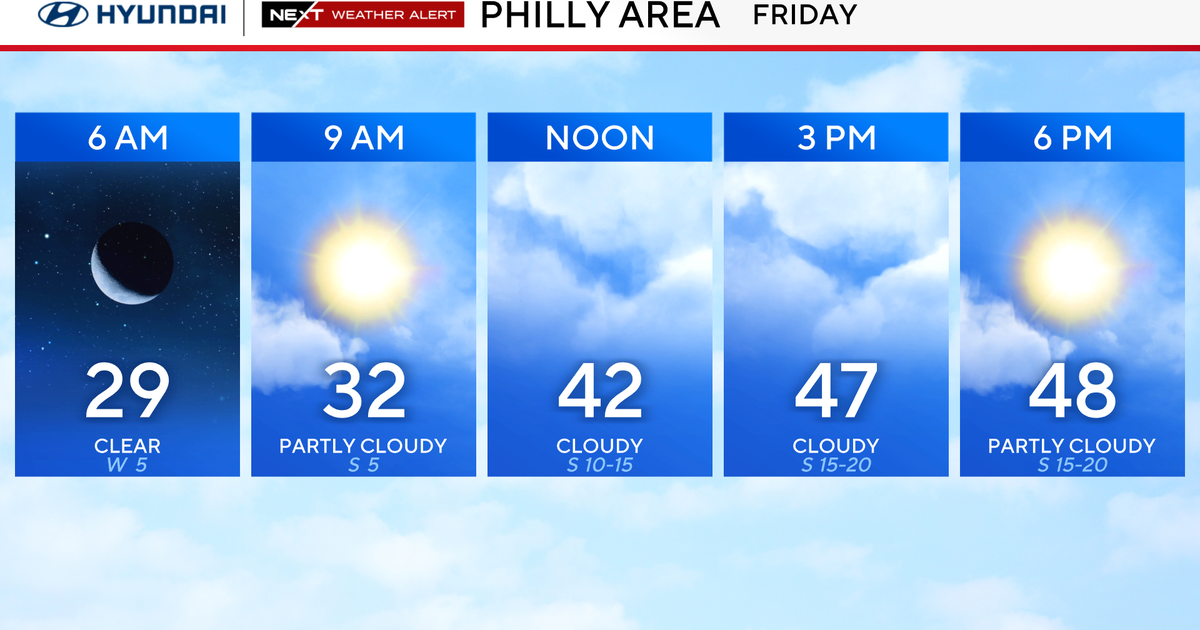
First Alert Weather: Highs in upper 50s Monday, tracking rain Tuesday
Alert: Yellow Alert for tomorrow (Tuesday) for some gusty showers (wet snow showers farther north), especially into the PM which could slow down the commute in spots.
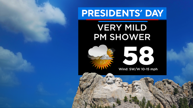
Forecast: Mostly cloudy this morning with some brighter breaks this afternoon. It will be unseasonably mild again with highs in the upper 50s (low 60s south). That's more like early April and about 15 degrees above normal. Most of the daylight hours will remain dry, but a few showers are possible by late afternoon, mainly to the west.
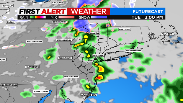
Tonight will see scattered showers/sprinkles around with lows in the 30s. As for tomorrow, expect some spotty morning showers (flakes north) followed by a better risk of some gusty showers in the afternoon. Temps will range from the 50s S&W to just the 40s N&E.
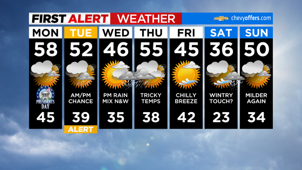
Looking Ahead: Any leftover showers tomorrow quickly depart into the evening with clearing skies behind. Wednesday starts off bright and dry before clouds quickly increase ahead of our next system. By late Wednesday afternoon, some rain will move in, along with the chance of a wintry mix north and west. If the current trend continues, Wed. PM into Thu. AM would likely be our next alert period (stay tuned). Highs will be in the 40s.