First Alert Weather: CBS2's 9/21 Wednesday morning forecast
Advisory: High rip current risk, big waves along the coast likely tomorrow into the start of the weekend due to Fiona.

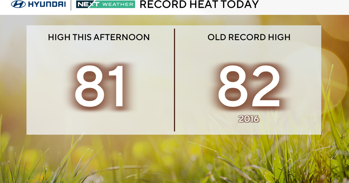
Forecast: Today will be mostly sunny and warm. Expect highs around 80. An iso'd shower/rumble is possible tonight with the best chance N&W, otherwise, expect increasing clouds with milder temps in place.

As for tomorrow, there's still some uncertainty regarding the timing of the showers, but at this point it looks like they'll push through our northwest suburbs during the AM commute; arrive during or slightly after the tail-end of the AM commute in the city; then sweep through the remainder of the area by early to mid-afternoon. After that, we'll see partial clearing with highs only in the low 70s.

Looking Ahead: Friday will be mostly sunny, blustery and even cooler with highs only in the mid 60s... feeling like October.

Saturday will remain cool with mostly sunny skies and highs in the upper 60s. As for Sunday, temperatures start to bounce back with highs in the mid 70s.