First Alert Weather: CBS2's 11/13 Sunday morning forecast
It turned out to be a gorgeous Saturday afternoon with sunny skies and record-breaking temps that soared into the upper 60s and low 70s. Unfortunately, the lovely weather will not be sticking around, as rain and cooler temps move in.

Saturday evening, clouds increased, and we saw a low of 48. Showers started to infiltrate the region between the hours of 1-3 a.m., becoming more numerous towards daybreak. A few snow showers may have been mixed in for our far northwestern suburbs, although no accumulation was expected. The heaviest and most widespread rain looked to occur around 7:30 a.m. Rainfall totals look to remain below a quarter of an inch.
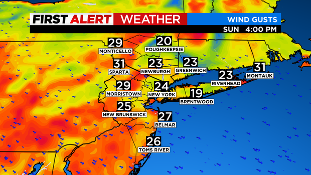
The rest of Sunday will feature clearing skies for most, with lingering showers possible for the eastern end of Long Island, and then a stray rain or snow shower for areas north and west of the city. It will be blustery and much cooler, with a high of only 52. Wind gusts will average between 20-30 mph at times, which will make it feel even colder.
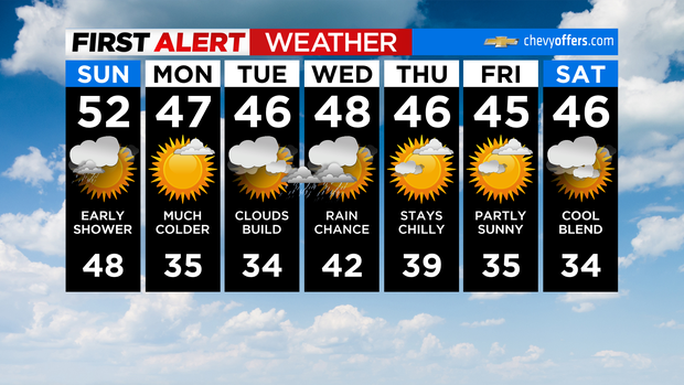
Sunday night will see temps plummeting even further, with widespread 20s and 30s. We'll go from having September weather to December weather in a snap!