First Alert Weather: Catching a break Saturday before Sunday's Yellow Alert
We won't have much sunshine this weekend, but Saturday is definitely the drier half. A chilly rain arrives for Sunday, along with some wintry weather for some.
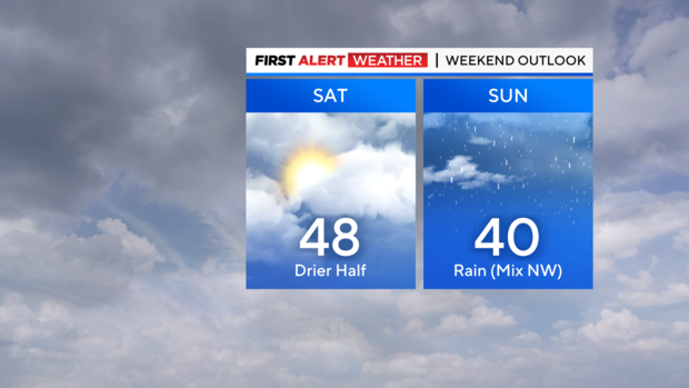
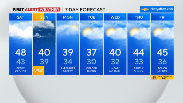
Your Saturday will stay mostly cloudy with just a few peeks of sun here and there. We'll still be about 10 degrees above normal with highs in the mid and upper 40s this afternoon. If you're heading out through this evening, things remain dry.
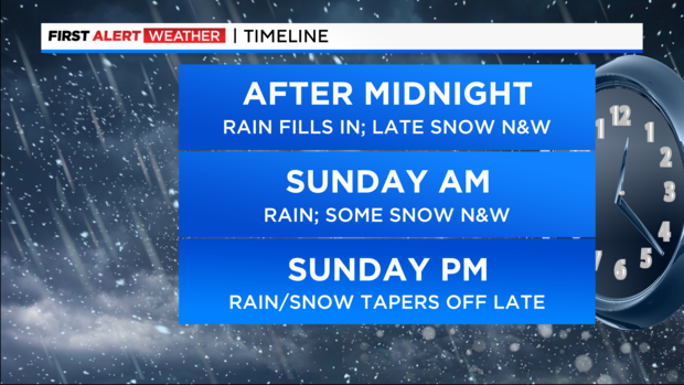
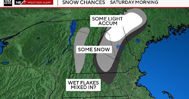
After midnight, rain will be working in from the southwest and will overspread the area through the early pre-dawn hours. This is a mainly rain event for much of the region, the exception being far N&W where there will be enough cold air to support snow. Specifically, in the higher elevations of NW NJ up into the Catskills.
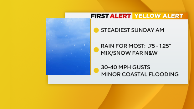
We've issued a Yellow Alert for Sunday morning. This is not a blockbuster system and won't have a widespread major impact... but it's enough that it'll slow you down if you'll be traveling tomorrow morning. Expect rain with some heavier bouts to move through, and mix/snow for Sullivan, Ulster, Dutchess and down into parts of Orange and Sussex counties. This will continue through midday Sunday. It's the same story for wind and any coastal impacts... nothing overly concerning, but some 40 mph gusts along the coast will be possible, along with some minor coastal flooding in spots.
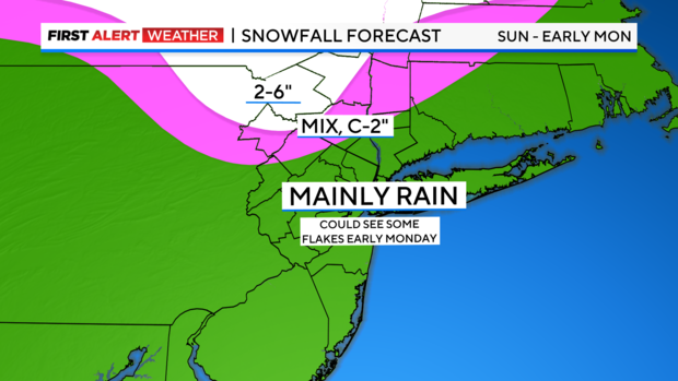
Into Sunday afternoon, rain turns lighter and more on & off for the remainder of the day. For the evening hours, the rain/snow line shifts south, but with much of the precip exiting and marginal surface temps, don't expect much accumulation where the changeover occurs. It's really north of I-84 where the biggest impacts from snow will be... a general 1-3" there with parts of Sullivan and Ulster possibly seeing 4-6". Again, this would be localized to those highest elevations. Farther south, expect around an inch or so of rain, and possibly a slushy inch of snow/sleet north of I-80.
Late Sunday night into Monday morning as colder air moves in, some flakes could make their way into the city and the coasts. It won't be anything more than a novelty by then with perhaps a coating on the colder surfaces.
After that, things are looking seasonably chilly but dry through much of next week.