Red Alert: Bracing for bitter cold to end the week
Advisories: Wind Chill Warnings and Wind Chill Advisories N&W tomorrow into Saturday morning for feels like temps of -20 to -40 degrees.

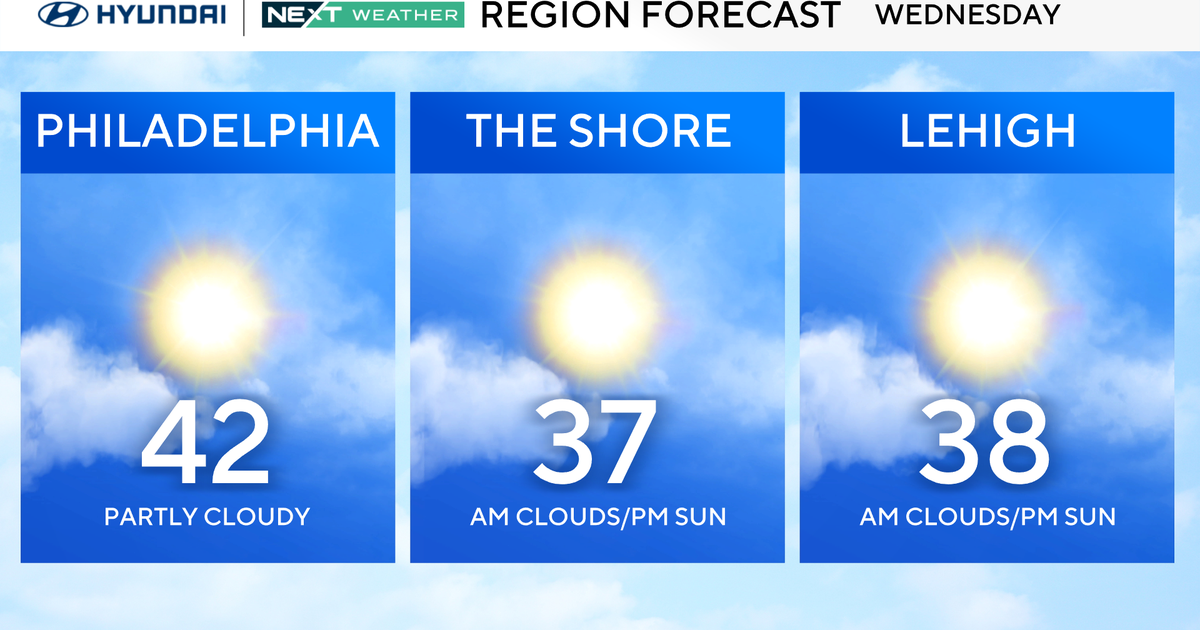
Forecast: Today (Groundhog Day) will be partly cloudy to mostly sunny, breezy and a touch milder with highs in the low 40s. We'll see a passing snow shower N&W late tonight as our arctic front pushes through. Wind chills will fall into the teens near daybreak.

As for tomorrow, it will be very cold and windy with wind chills in the teens, single digits... below zero later in the afternoon and at night. As for Saturday, it won't be quite as windy, but feels like temps will only get into the single digits and teens.

Looking Ahead: Sunday will be a bit milder with highs in the 40s. Temperatures will likely remain above normal (40s, 50s possible) into the start of next week.