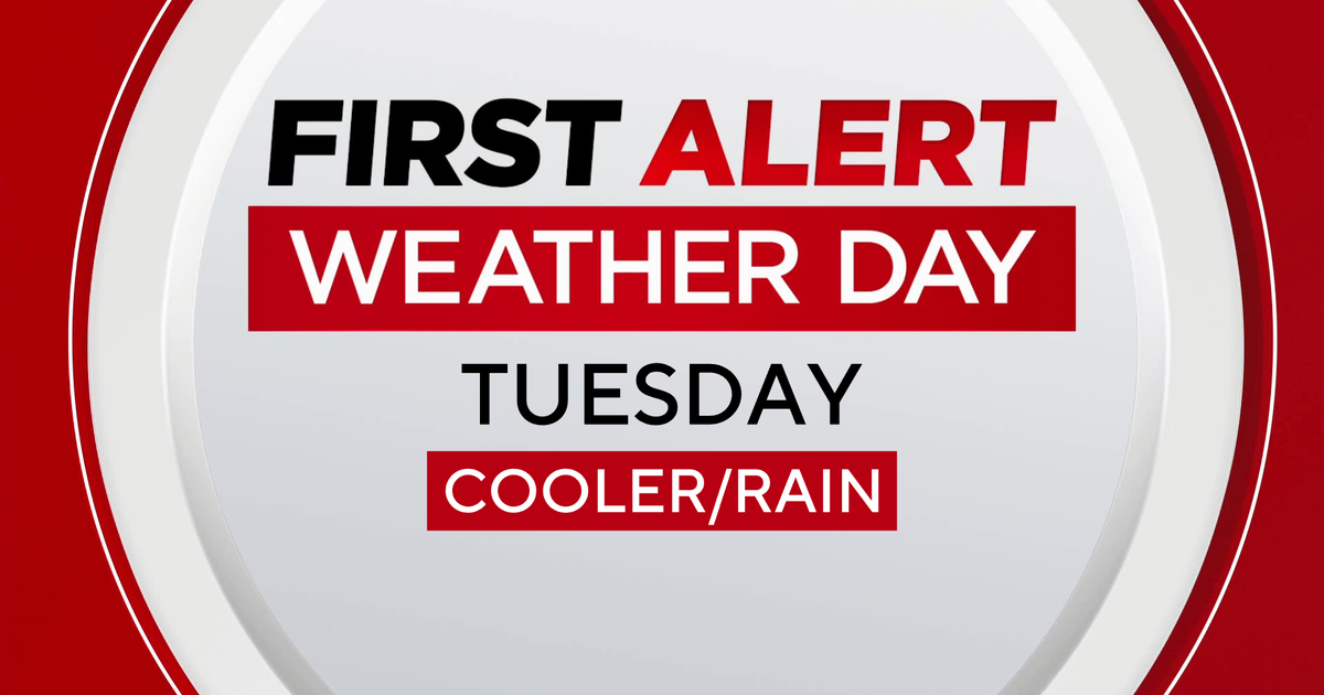
First Alert Forecast: Temps Reach Upper 50s Before Big Changes Saturday Night, Light Snow After Midnight
By Matt DeLucia, CBS2 Meteorologist/Weather Producer
Get outside today! It's the last of our taste of spring before big changes come tonight. Expect highs in the upper 50s to around 60 this afternoon under a mix of sun and clouds.
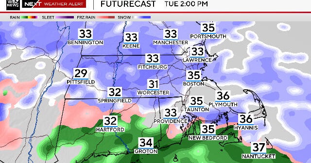
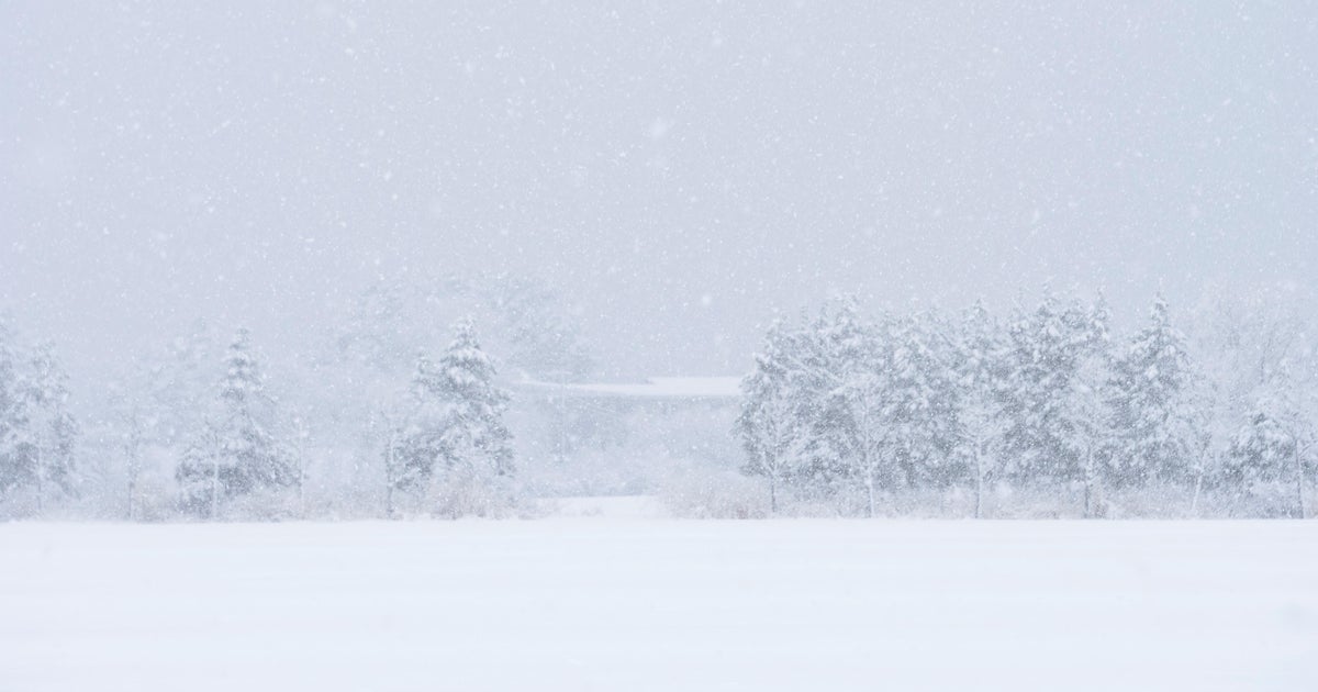
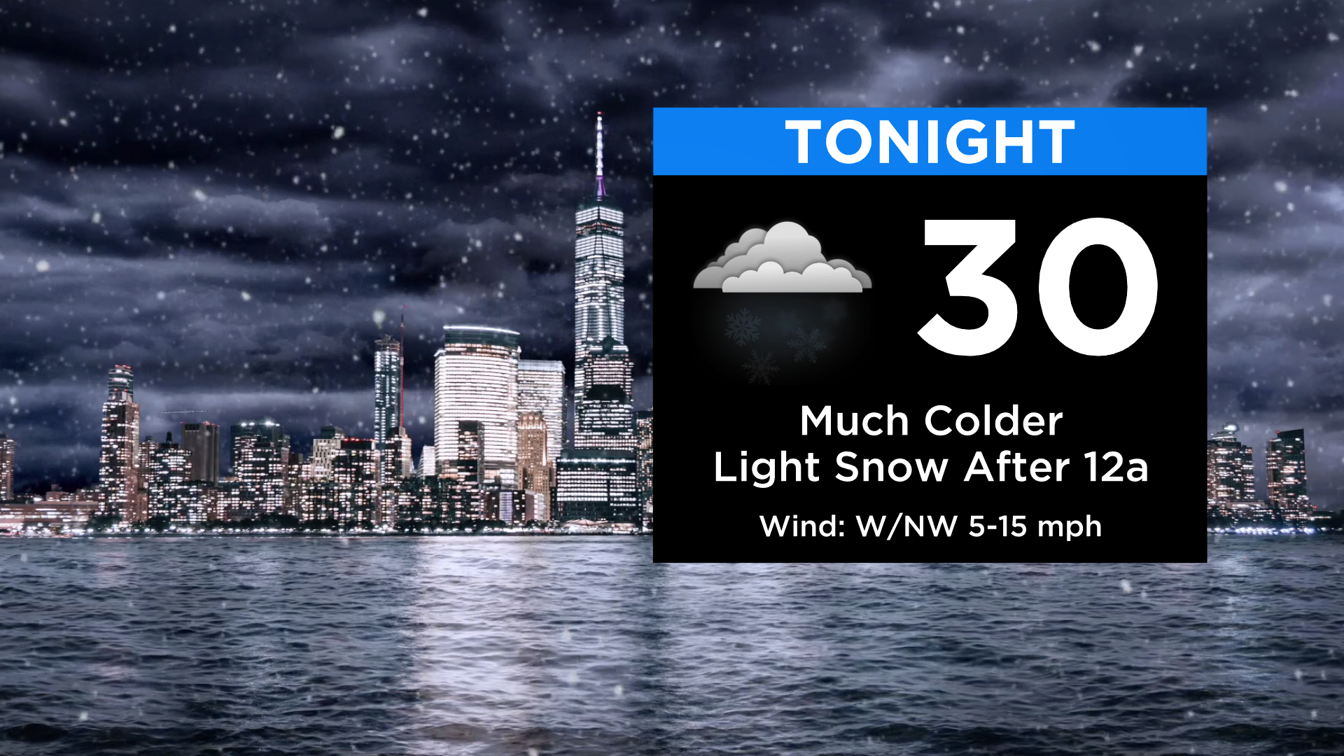
A strong cold front then swings through this evening. Temps will crash into the 20s to around 30 degrees overnight, and yes... a quick round of light snow moves in after midnight.
This is not a big storm and won't cause too many issues. There's a chance that locations farther N&W see something more than some flurries.
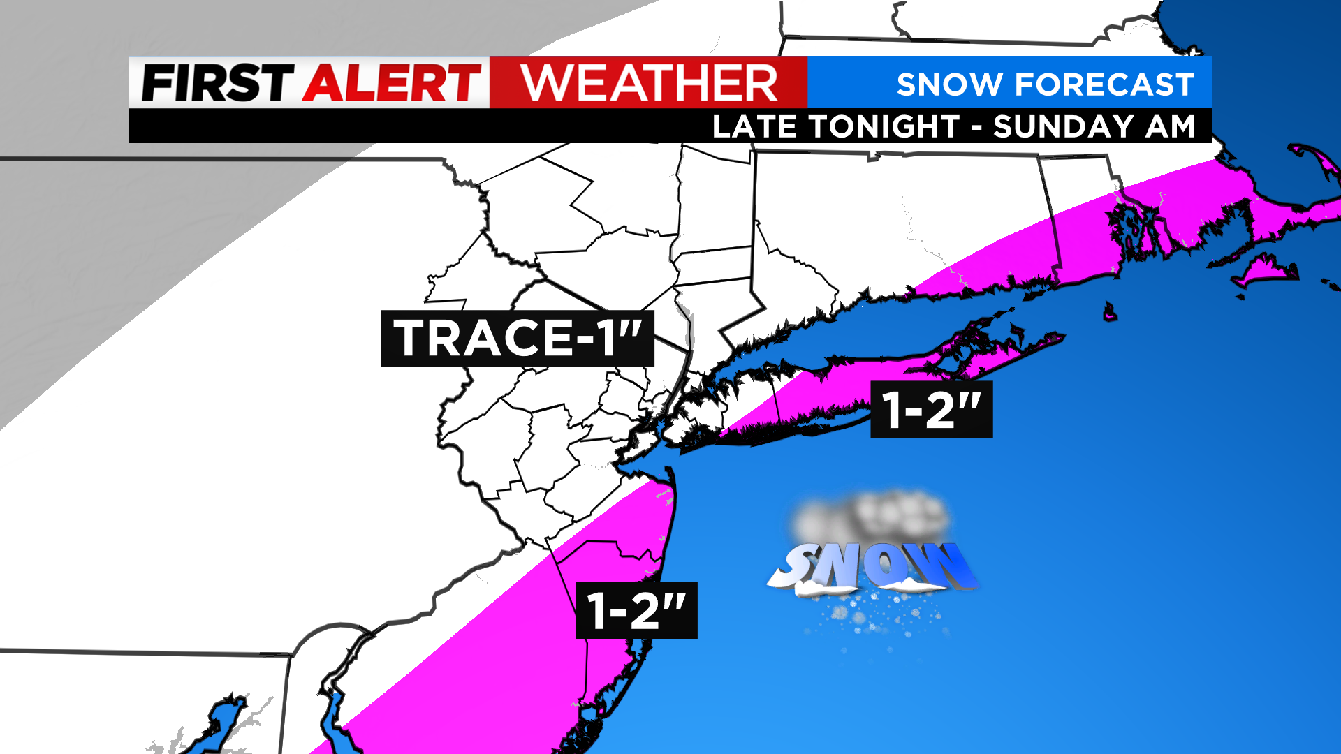
The most snowfall will occur along the coasts where 1-2 inches (even some isolated 2-3 inches) will be possible. New York City likely ends up with about an inch or so.
Any leftover flakes quickly exit by early afternoon with perhaps some breaks of sun, especially to the west.
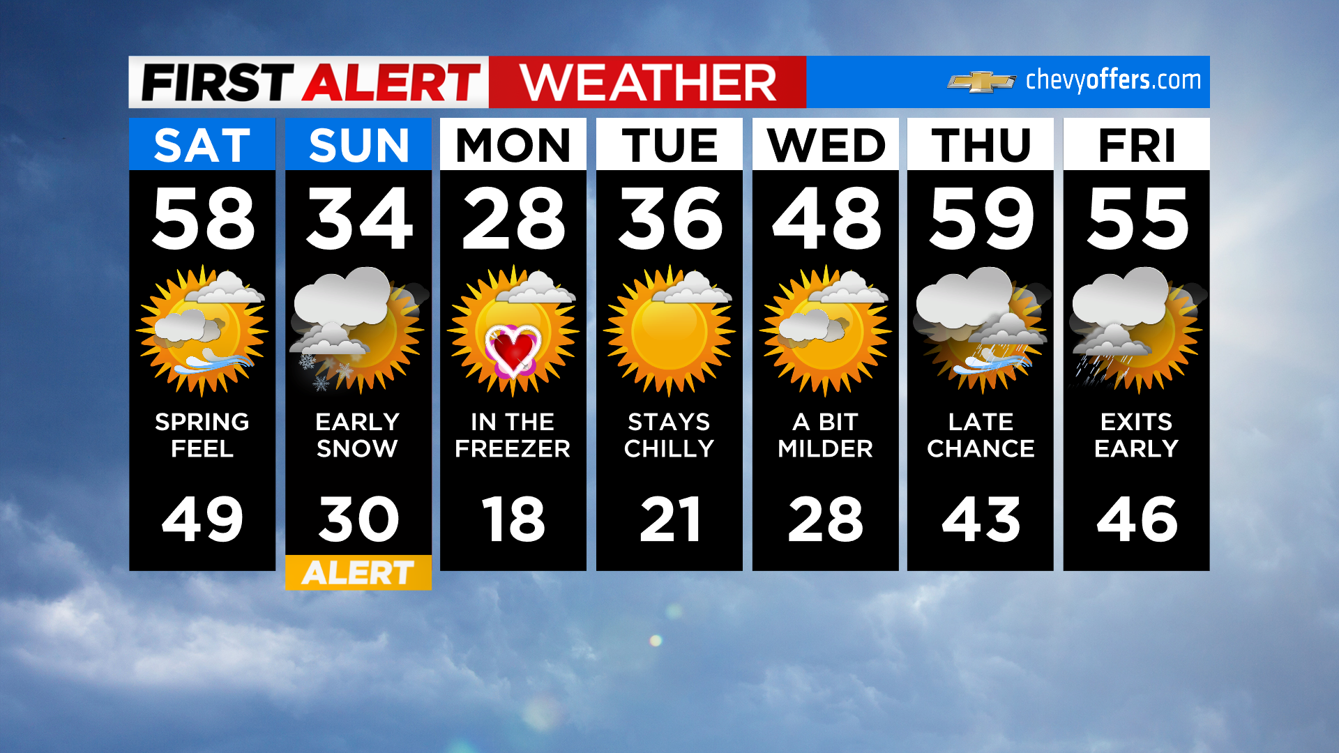
Highs Sunday will struggle to get above freezing with wind chills in the 20s all day.
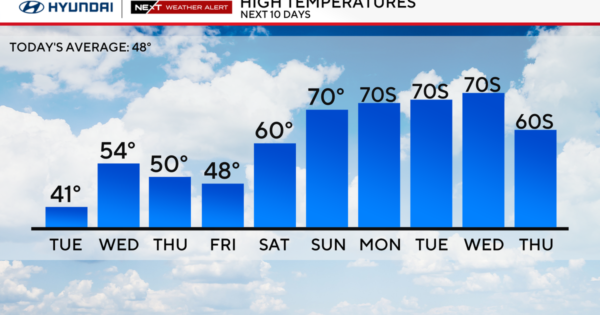
The core of the cold will be on Valentine's Day before temps climb again into next week. Have a great weekend!