First Alert Forecast: Storms possible this afternoon and tonight, not ideal for lunar eclipse viewing
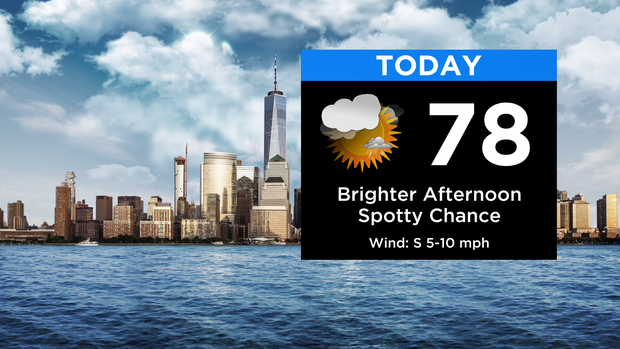
After a cloudy start with areas of dense fog, skies will be brightening up heading into the afternoon.
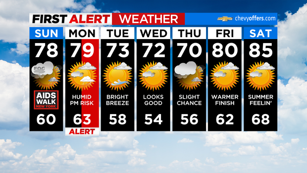
It's a warmer and overall drier finish to the weekend, although a spotty shower or thunderstorm is possible, primarily to the north and west. Highs will be in the upper 70s around the city and low 80s inland.
After a leftover shower or thunderstorm this evening, we clear a bit overnight.
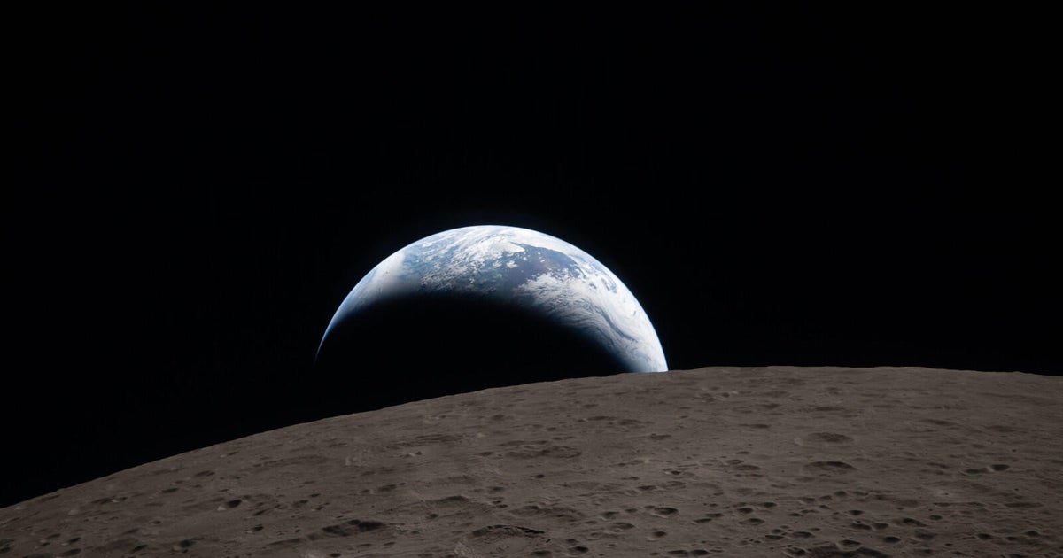
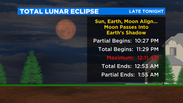
Viewing for the total lunar eclipse tonight won't be ideal, but we're hopeful for some breaks in the clouds. It'll really depend on your location. Maximum totality occurs just after midnight, giving the moon that rusty orange/red color.
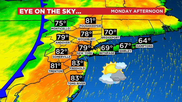
Monday itself starts off mainly dry, but we'll need to watch for a line of strong to severe storms Monday afternoon ahead of a cold front. The greatest threats will be damaging wind gusts, small hail and heavy downpours, but an isolated tornado can't be ruled out.
The evening commute will likely be slow as the storms move through.
Things turn pleasant for midweek with temps in the low 70s.
Enjoy the rest of your weekend.