First Alert Forecast: CBS2's 2/27 Sunday morning update
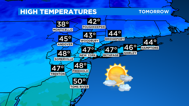
Sunday will be a roller coaster of a day. We'll begin the day with sunny skies and gusty winds ahead of an arctic front. Gusts could reach up to 35 mph at times. Temps will be rather mild with highs in the middle to upper 40s.
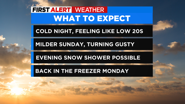
I wouldn't be surprised if a few locations across central and southern New Jersey reach the 50-degree mark. High 47.
As the front draws closer by Sunday evening, winds will continue to be gusty, and some snow showers are likely to develop across the area. A snow squall is also possible, but this is mainly for our far northern counties, and not likely to have the intensity of the snow squall of last weekend. No accumulation is expected anywhere.
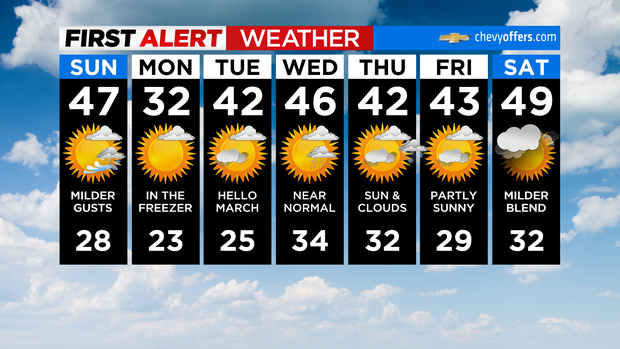
Once the front moves through and snow showers clear out, temps will plummet into the teens and twenties as arctic air funnels in. Winds will slacken a bit, but still be strong enough to produce wind chill values in the teens and single digits, with sub-zero readings in the northern suburbs. Sunday night's low will be 23.