Clear and cool Christmas Eve, but all eyes are on Friday's snow
Merry Christmas Eve!
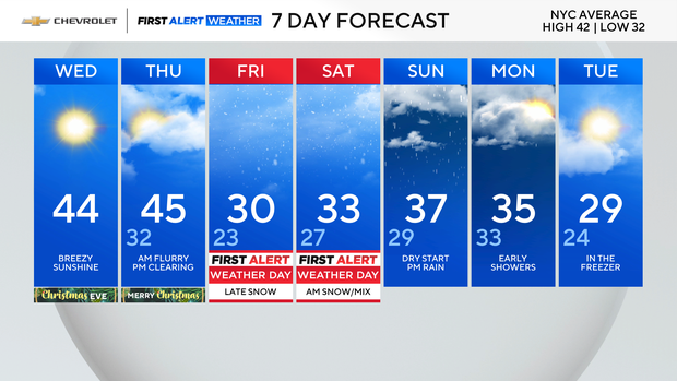
Other than increasing clouds, Wednesday night will be quiet for Santa. Lows will be in the 20s for most, and the low 30s in the city.
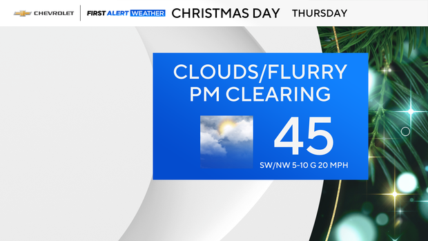
As for Christmas Day, things start out mostly cloudy with even an isolated flurry in the air. We should get some clearing into the afternoon. Temperatures will again be in the mid 40s. With less wind Thursday, it won't feel as cold.
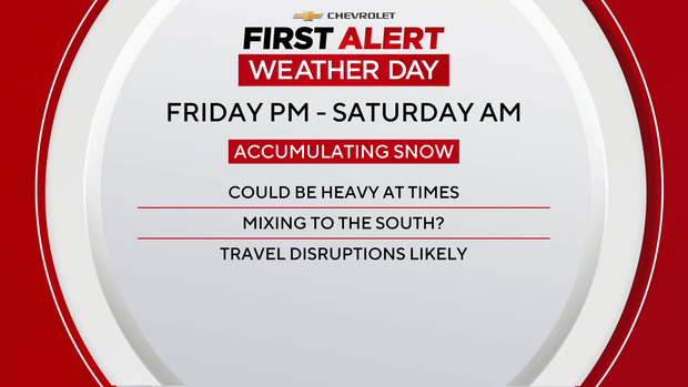
Our eyes then turn to Friday and the next storm to hit the Tri-State Area, which has led us to issue a First Alert Weather Day.
The timing is Friday evening into Saturday morning, and models are in agreement we'll be seeing a plowable snowfall.
An early call would be 4-8 inches for many, with 8 or more for areas north and west of the city. It will ultimately depend on the track, so expect some updates to the snow map as new data comes in.
Either way, confidence is fairly high in a snowfall starting Friday evening with travel disruptions overnight into Saturday morning.
Keep it tuned here, and we'll bring you all the latest watches, warnings and alerts. Have a safe and enjoyable holiday!