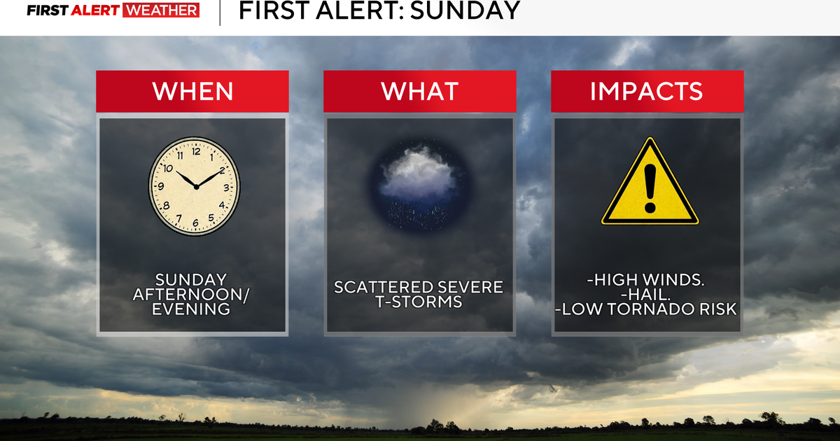
A strong El Niño could deepen drought conditions in Minnesota

El Niño is here and a super El Niño could be on the way, but what does that really mean?
"El Niños are typically associated with warmer than normal temperatures and slightly drier than normal seasons," according to Luigi Romolo, a state climatologist with the Minnesota Department of Transportation.
During an El Niño, there are warmer-than-average sea surface temperatures that impact the upper air pattern, specifically looking at the Pacific jet stream. That shifts a little further to the south, allowing for warmer air to be in place across the upper Midwest.
"If the El Niño were to explode more over the summer, we could see our drought conditions get a little worse here in the state," Romolo said.
But there is usually a greater impact in Minnesota during the winter.
"Less snow and more midwinter melts. So you know, the more days in late December and January where we get above freezing, we wouldn't be retaining our snow," Romolo said.
The last strong El Niño winter season was between 2023 and 2024, often referred to as the "Lost Winter," dominated by bare ground and title holder of the warmest winter on record for the state of Minnesota, although there was another factor at play.
"It really had to do with the fact that the El Niño kind of occurred and strengthened while we were in a drought," Romolo said.
The prediction gives an idea of what to expect if this El Niño holds through the winter, but there are outliers.
"The actual Halloween blizzard also occurred during an El Niño. So, I would expect that with the strength of this particular El Niño, that we should expect warmer than normal conditions and slightly less precipitation," Romolo said.