Potentially severe weather moving into Minnesota this weekend following pleasant Thursday


Thursday will be another gorgeous one in the Twin Cities, but the threat of severe weather looms for Friday and Saturday.
Highs will be in the upper 60s on Thursday with a mix of sun and clouds, making it the metro's third day in the 60s so far this year.
Winds will pick up later in the day, ushering in highs in the 70s on Friday with the potential for some record daily high temperatures. The metro typically sees its first 70-degree day around April 12, and May 17 is when the average high reaches into the 70s, so this is going to be well ahead of schedule.
Friday and Saturday will be NEXT Weather Alert days with the warmth and moisture in the atmosphere bringing the potential for strong to severe thunderstorms.
There is a slight risk — or level 2 — in eastern Minnesota. For southern Minnesota cities like Owatonna and Winona there will be a marginal threat, or level 1.
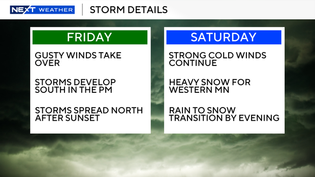
Friday forecast
Thunderstorms with wind and hail will be the main threats on Friday. There's always going to be a lot of wind energy in the atmosphere, and the storms will tap into some of that.
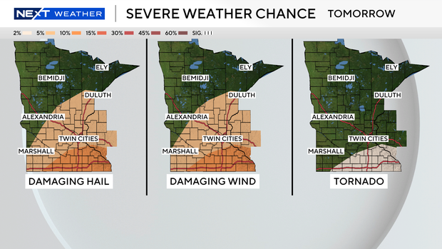
There could be a stray shower on Friday morning, but the main show doesn't get going until later into the evening hours. After the sun goes down, you lose the instability in the atmosphere, but some of these earlier storms before midnight do have the potential to have some wind and hail.
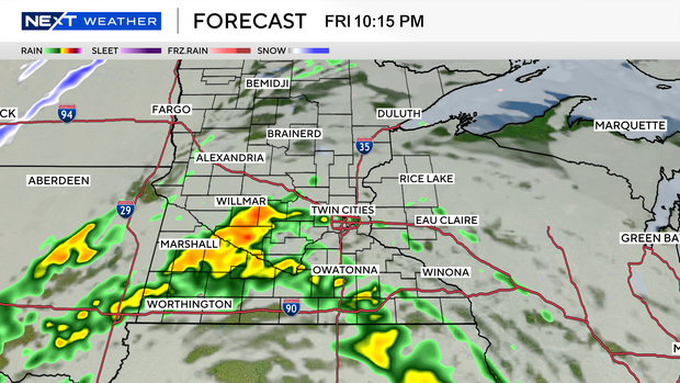
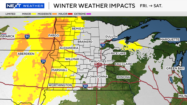
There's still going to be wind and on the backside is where we're talking snow, with 3-6 inches possible for southeastern Minnesota by Saturday afternoon, though the metro will likely just see a coating or dusting.
Saturday forecast
Snow will carry through from Friday into Saturday. It'll be heavy, blowing and drifting snow. Areas that are expected to see the worst of it are in western Minnesota.
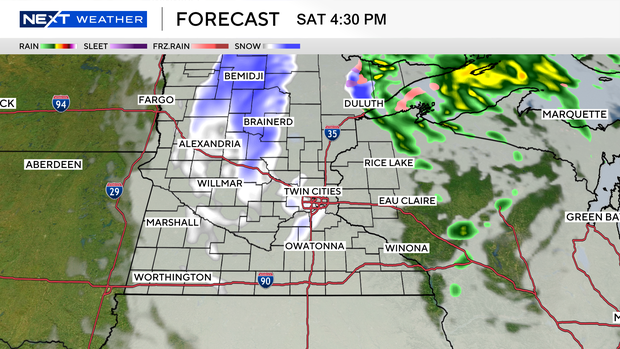
Strong winds — anywhere from 40 to 50 miles per hour — will blow the snow, likely making driving conditions difficult.
Western Minnesota will get the brunt of the storm, whereas the metro area will likely only see a transition with a half an inch or so in the evening.
Sunday forecast
Sunday's highs will drop into the 30s before temps warm back into the 40s and 50s early next week.
As temperatures rebound into the 50s and 60s next week, there is another potential for a midweek storm system.
As severe weather season begins, the National Weather Service is improving how warnings are related in the metro area. Instead of all of Hennepin County being alerted, there are now six smaller zones that will only be notified if a warning is issued in that area.