Cooling begins Tuesday in Minnesota; air quality alert for state through Saturday


Minnesota is headed for a much-needed break from the intense heat and humidity, but air quality concerns will linger over the state through the weekend.
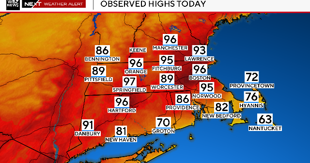
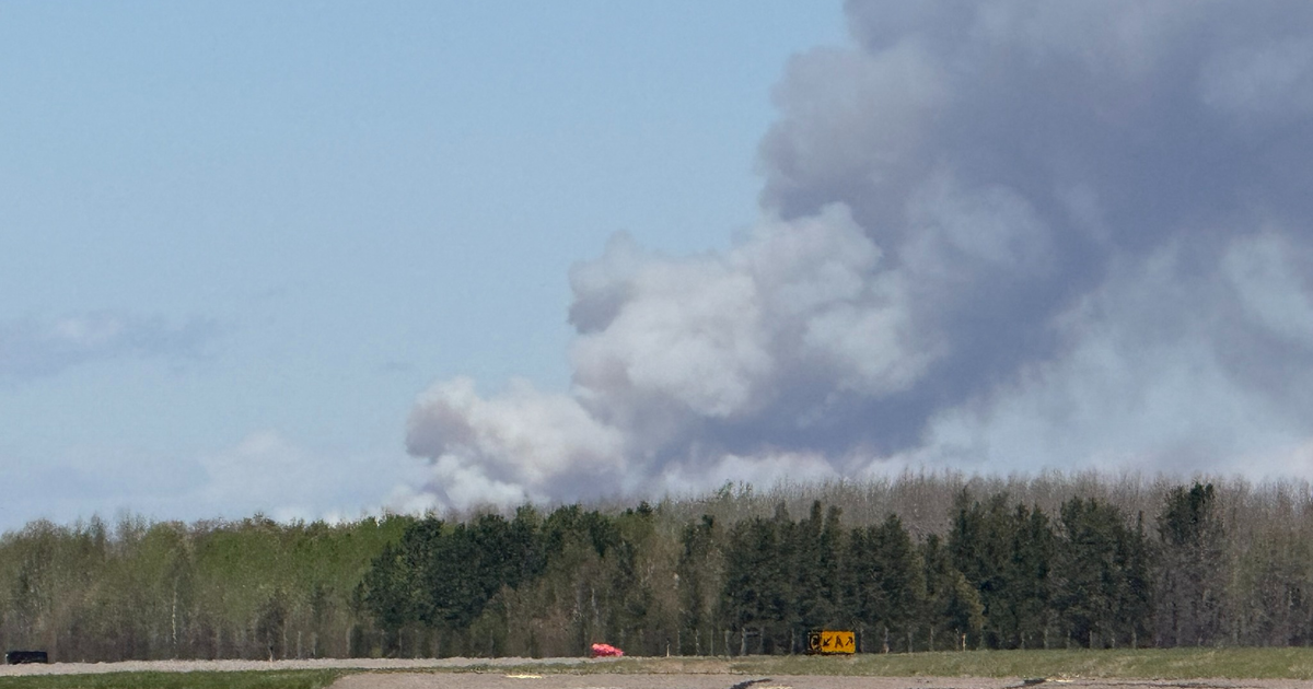
Expect highs in the lower 80s on Tuesday with moderate dew points, which will drop by night. Then, winds turn breezy from the northwest, helping usher in cooler, drier air. However, the wind will bring smoke from Canadian wildfires. As a result, an air quality alert is in effect for the entire state through 5 p.m. Saturday.
The air quality index (AQI) is expected to be in the red category, a level considered unhealthy for everyone, for most of the state. South of the Minnesota River, the AQI is forecasted to reach the orange category, which is considered unhealthy for sensitive groups.
The Minnesota Pollution Control Agency says this is one of the longest air quality alerts on record, tying with those issued for St. Louis County during the Greenwood fire in 2021.
A few isolated showers or weak storms are possible later on Tuesday, mainly in southern Minnesota during the afternoon and overnight hours.
A quiet, pleasant stretch begins midweek, with sunshine and highs in the upper 70s through Friday. There's a chance for rain again on Saturday.
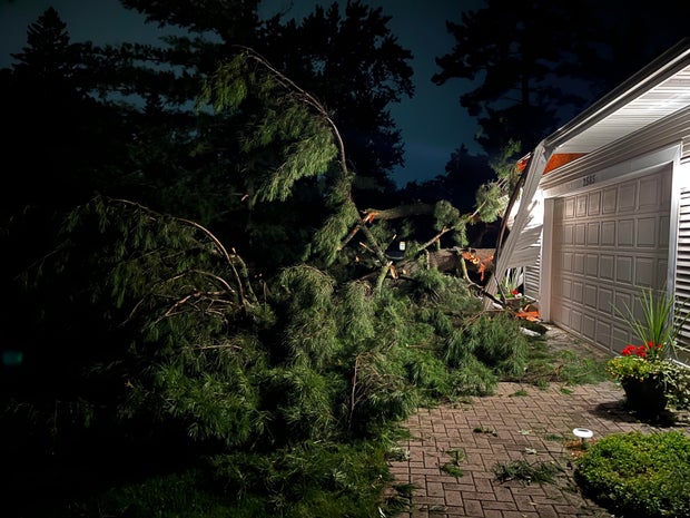
More damage from Monday's storms
While many across Minnesota were still cleaning up from Sunday's severe weather, Monday's storms brought more damage and power outages.
As of Tuesday morning, about 72,000 people were without power in the Twin Cities, according to Xcel Energy. Though Xcel had restored power to most of its customers during the day Monday, the additional activity caused outages to spike again in the evening.
Downed trees were a common sight in the Twin Cities on Tuesday thanks to strong winds during the overnight storms.