The latest look at when snow is expected to hit Southeast Michigan on Wednesday, and how much

(CBS DETROIT) — Southeast Michigan's first big winter storm of the season arrives during the evening commute on Wednesday.
Snow will begin Wednesday afternoon and linger into Thursday morning. From 1 p.m. Wednesday to 7 a.m. Thursday, a winter storm warning will go into effect for Macomb, Sanilac, and St. Clair counties, while Oakland, Lapeer, Livingston, Monroe, Lenawee, Washtenaw, and Wayne counties will be under a winter weather advisory.
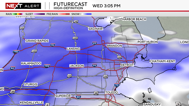
Western counties like Livingston, Washtenaw and Lenawee will likely see the first snowfall early Wednesday afternoon around 1 p.m., with heavier snow moving in by 3 p.m.
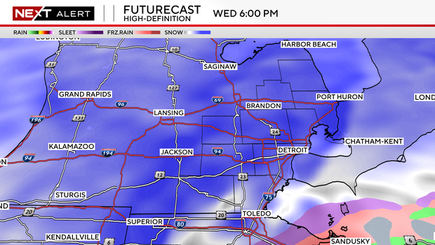
Some of the heaviest snow begins to fall by 6 p.m. for all of Southeast Michigan.
Snow totals will add up quickly through the evening for many driving home Wednesday night.
By late Wednesday night and early Thursday morning, most counties can expect an accumulation of five to eight inches.
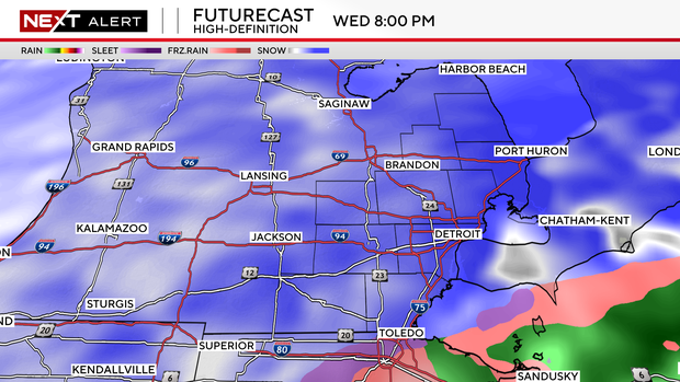
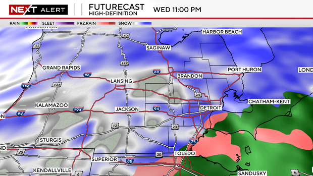
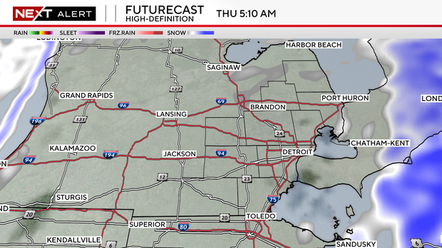
Heavy snow will continue after the Wednesday commute and will impact any evening plans. Even as late as 11 p.m. there will be pockets of heavy snow beginning to taper off.
There will also be a chance for some minimal ice accumulation in southeastern Monroe County late Wednesday night.
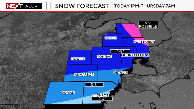
Some areas in Sanilac County could see up to 10 inches of snow.
Unplowed and untreated roads will be difficult to travel by Wednesday evening.
With some added snowfall overnight, travel could be troublesome for the Thursday morning commute.