Tracking snow for Southeast Michigan on Saturday. Here's what to expect

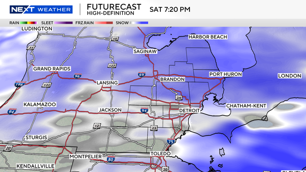
(CBS DETROIT) - An active weather pattern continues with the next system on track to bring snow to much of Southeast Michigan from Saturday afternoon to evening.
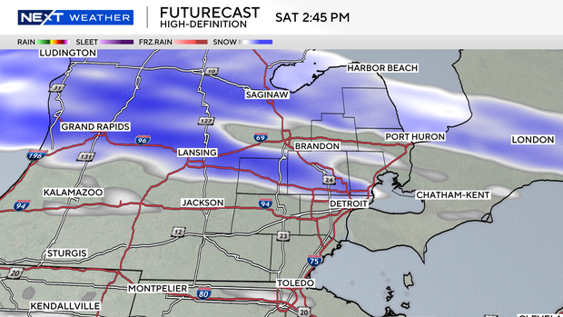
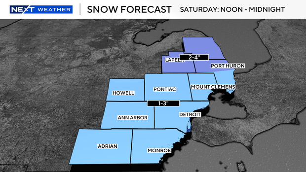
Expect a general 2 to 4 inches of snow along and north of I-69 before snow tapers off Saturday night with the potential for a brief period of higher snowfall rates late Saturday afternoon and evening.
For the Metro Detroit area, most of us will see 1 to 3 inches of accumulation.
While the models agree that a messier wintry mix and/or freezing rain will remain farther south into Ohio, there is potential for a brief transition to freezing drizzle for our area as the snow comes to an end Saturday night. This could cause slick conditions on untreated roads as the overnight temperatures fall back into the low 20s.


