Heat, humidity and storms move into southeast Michigan midweek


(CBS DETROIT) - Heat, humidity and storms will take hold of the weather pattern over the next 24 hours.
Evening and overnight storms will have the potential to be strong to severe. However, with this weather forecast, make sure you are staying weather-ready all throughout the night as storm evolution tonight is very fluid.
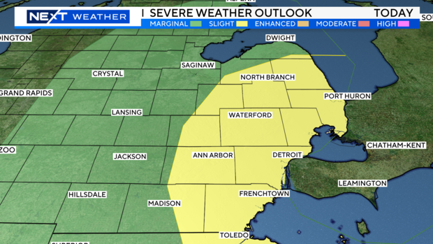
The biggest threats for severe weather will be damaging wind, large hail, flooding, and an isolated tornado. Most of SE Michigan has been upgraded to a SLIGHT risk to account for this. (Level 2 out of 5). However, heavy rainfall may also bring localized flooding.
Storms will also be possible on Thursday, especially early in the morning and late in the evening.

The Storm Prediction Center has our southern zones under a MARGINAL risk for the severe potential Thursday.
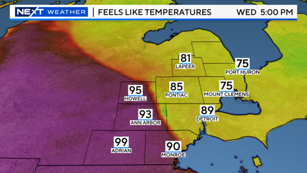
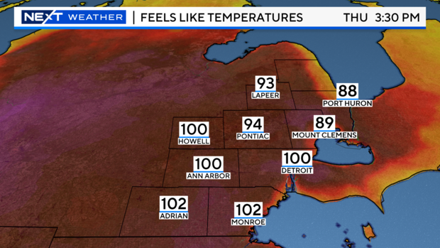
High temperatures will be hot today and tomorrow, along with the stormy weather. Humidity levels will also be high, so feels-like temperatures will climb into the 90s and even triple digits Thursday afternoon. Heat Alerts may be issued to account for the dangerous heat on Thursday. Be safe, know heat-related illness signs and find ways to beat the heat.
Your NEXT Weather Team is monitoring the severe weather threat and the hot temperatures, so stay tuned to CBS News Detroit on air and online at CBSDetroit.com, our CBS News Detroit app, and on Pluto TV.