Frigid conditions to persist across Southeast Michigan throughout workweek

Expect frigid conditions Monday through Friday in Southeast Michigan with morning wind chills often reaching 15 degrees below zero or colder.
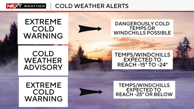
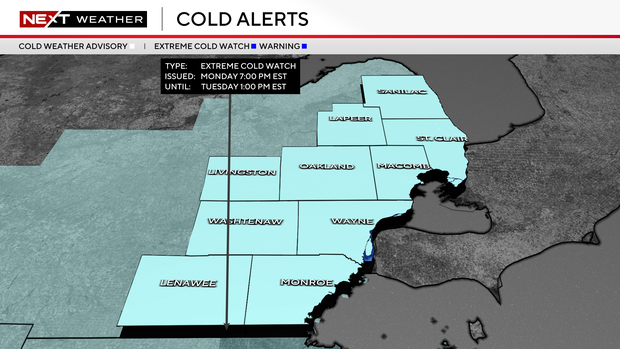
A cold weather advisory will be in effect from 7 p.m. Monday to 10 a.m. on Tuesday.
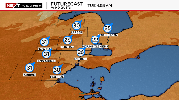
Strong winds ahead and behind an arctic front moving through on Tuesday will set the stage for wind chills reaching 15 degrees below zero or colder.
This is the first round of dangerous wind chills expected during the workweek. Low temperatures Monday night will be between 5 degrees below zero and 5 degrees, and we can expect to see those repeated Tuesday night. Sustained winds between 10 and 15 mph will bring another round of wind chills around 15 degrees below zero on Wednesday morning.
Even colder air is expected to arrive Wednesday night with temperatures bottoming out between zero degrees and 10 degrees below zero Thursday and Friday mornings. Although winds will be light, wind chills will still likely approach 15 degrees below zero.
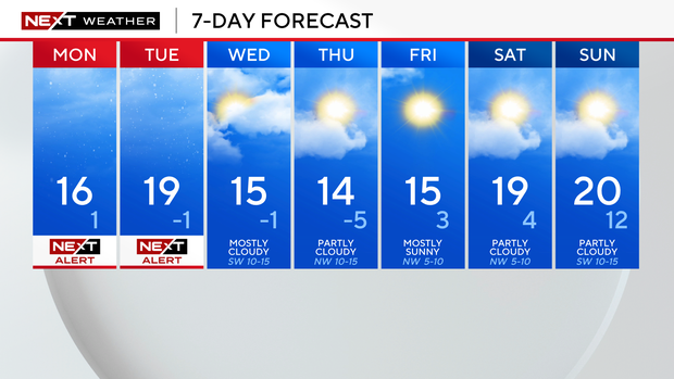
Frigid temperatures mean roads may remain snow-covered and slippery, especially at the beginning of the week, and there are a few more snow chances to add to the mix.
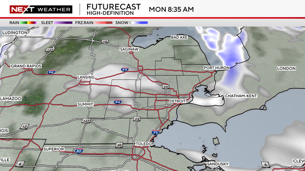
Minor accumulations, less than a half-inch, are possible Monday as lake effect flurries develop off Lake Michigan.
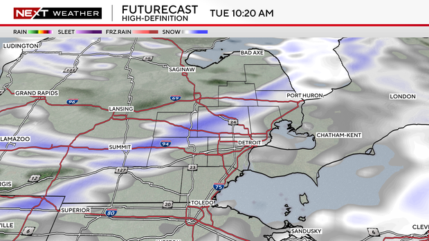
Snow showers associated with the arctic front on Tuesday are expected to produce a dusting of up to 2 inches of accumulation, and there is also a low chance for isolated snow squalls as wind gusts reach between 30 and 35 mph.
Stay with the CBS News Detroit NEXT Weather team for updates on the cold weather.


