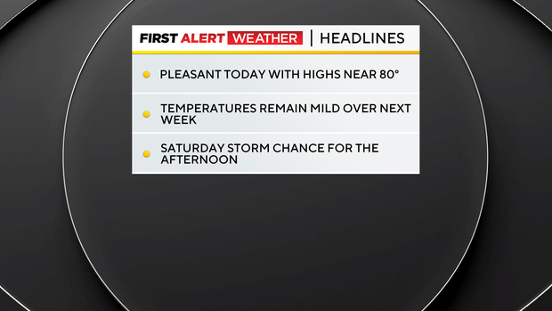
Cooler than normal conditions will be in place today for the Pittsburgh area

Cooler than normal weather conditions will be in place today for the Pittsburgh area.
Any Alert Days Ahead? Nope
Aware: I don't have a single above-average day when it comes to average temperatures over the next week.
You can say goodbye to the rainy pattern that August has been mired in and hello to mild weather that will be in place over the next ten days.
We only saw a trace amount of rain yesterday officially at the Pittsburgh airport, with our monthly total remaining at 5.84".
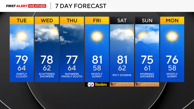
While the rainy pattern will return to more of what we would expect for this time of the year going forward, there will still be chances. I have our next rain chance coming on Wednesday, with rain beginning as soon as 11 a.m.
The good news is that moisture will not be abundant like we have seen, meaning rain totals that will not be very impressive. Most should see less than a tenth of an inch of rain on Wednesday.
Rain chances will stick around on Thursday, with scattered showers around for places mainly south of I-70. Places like Pittsburgh will not see much, if any, rain on Thursday.
Our next storm chance comes on Saturday afternoon, with rain and storms certainly possible as a cool front rolls through.
Saturday will likely see the most single-day rain total of the week, with most seeing at least a half inch of rain. We are still several days out but severe weather could be possible on Saturday as well. We will watch it.
With rain chances remaining fairly low over the next couple of days, it will put the focus on temperatures that you'd expect to see in the middle of September and not really in the middle of August.
Nothing will be record-setting, but I fully expect several mornings with morning temperatures dipping into the 50s, and in some cases even the 40s.
The average high for this time of the year is 82°, and I don't have us getting to 82° all week long.


