Another chance of severe storms in Southeast Michigan on Tuesday

(CBS DETROIT) - As temperatures heat up to highs in the mid-to upper-80s on Tuesday, more storms are possible.
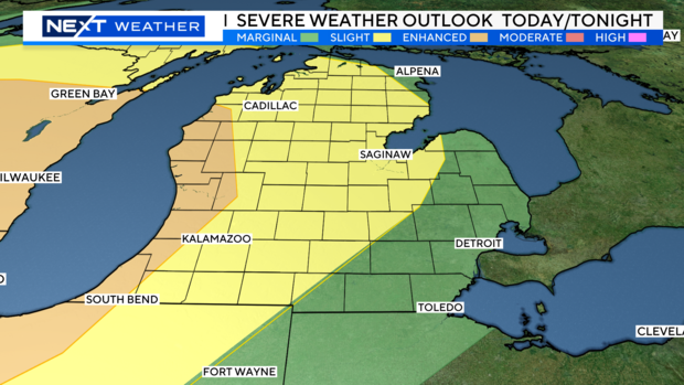
We can expect isolated, pop-up thunderstorms through this afternoon and evening, with another round possible overnight into early tomorrow morning. Most of us will be at a marginal risk for severe storms (one out of five). However, parts of Livingston County will be at a slight risk for severe weather (two out of five).
It's important to be weather-prepared and have multiple ways of receiving severe weather alerts. Even though weather models show many of these storms (especially the second round) dissipating before they reach Southeast Michigan, the potential for these storms is still possible.
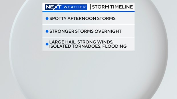
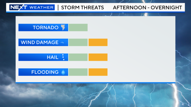
Still, our best chance to see severe storms in Southeast Michigan will be in the overnight hours until Wednesday morning as a cold front pushes through. We can expect chances for heavy downpours, localized flooding, hail up to 1 inch in diameter, wind gusts up to 60 m.p.h., and an isolated tornado cannot be ruled out.
While the correlating low-pressure system pushes north and east of Michigan, temperatures will still be hot on Wednesday, reaching into the mid-80s with afternoon sunshine and a chance of isolated (non-severe) thunderstorms.

For your latest NEXT Weather forecast, watch on air on CBS Detroit, online on CBSDetroit.com, or streaming on the CBS Detroit app, Paramount+, or PlutoTV.