Widespread accumulating snow expected in Denver and across Colorado Wednesday

Accumulating snow is expected to blanket Denver and much of the I-25 corridor throughout the day on Wednesday.
Timing will be key with this system. Snow spreads into the high country late Tuesday afternoon and begins developing in Denver between 1 and 3 a.m. That will lead to slick, snow-covered, and at times icy roads through the entire Wednesday morning commute.
Snow continues into the mid-afternoon before tapering off from north to south between 5 and 10 p.m. Snow ends in Denver around 5 p.m., with extreme southern Colorado finishing closer to 10 p.m.
Both the morning and evening commutes are expected to be impacted. Even though some melting is likely by Wednesday afternoon, temperatures will drop into the teens, allowing roads to refreeze quickly.

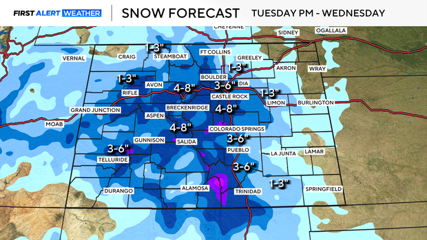
As of now, this is shaping up to be a general 3-to-6 inch (with some 4-to-8 inch totals) storm for much of the I-25 corridor. The one exception is north of Denver, where amounts are expected to be lighter with a general 1 to 3 inches.
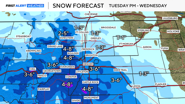
Winter weather advisories are in effect for Denver, Boulder, and Castle Rock.
As conditions clear on Thursday, temperatures will stay frigid.
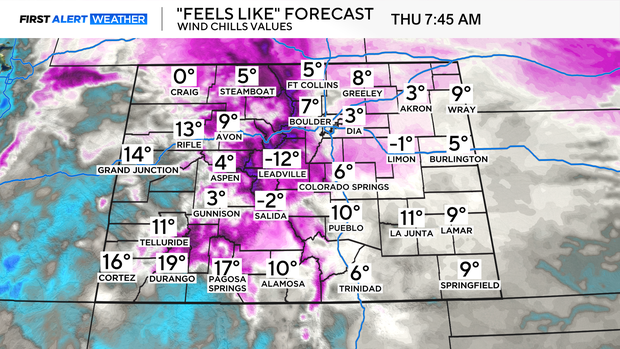
Wind chills will be near zero for many areas as you head out the door, whether you're waiting for the bus or driving to work.