Much needed rain and a welcome cool down for Colorado and the Denver metro area

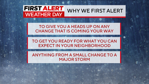
A First Alert Weather Day is in place for Tuesday for a cool down and much needed chance for rain. CBSColorado lets you know about a change in your weather pattern weather it is big or small just to get your family prepared for what is coming. Tuesday's storm is not a major storm but, will deliver a noticeable change from the stretch of unseasonably warm, near record temperatures of the last few days. Impacts for the morning and evening commutes will be minor.
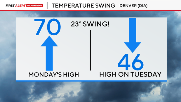
There will be two parts the this cold front coming through. The first is the overall temperature profile. High temperatures will tumble by as much as 23 to 25 degrees cooler than the 70s that popped on Monday in the Denver metro area.
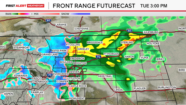
The second, big piece of our pattern shift is the much needed rainfall! Showers will develop over the Front Range and northeastern plains during the early morning hours. That could lead to a few wet roadways for the morning drive. Off and on rain showers may occur through day right on into the afternoon.
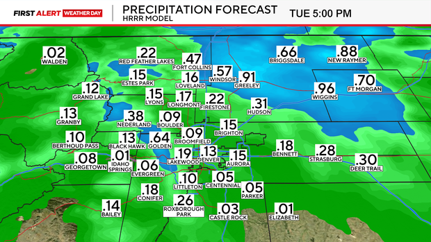
Rainfall amounts may range from a tenth of an inch to a quarter inch around the Denver metro area with larger amounts in northern Larimer, Weld, Morgan and Logan counties.
Northern and central mountain areas may see 2 to 6 inches of snow through Tuesday night. Some roads may be a bit slick. Conditions will improve quickly on Wednesday with the return of mostly sunny skies and warmer temperatures.


