Severe storms and flash flooding are possible Wednesday across Denver and eastern Colorado

A new round of storms arrives Wednesday with possible hail, strong winds and flash flooding. A surge of deep moisture and weak upper-level flow will create favorable conditions for slow-moving downpours. Storms could produce 1 to 2 inches of rain in a short period.
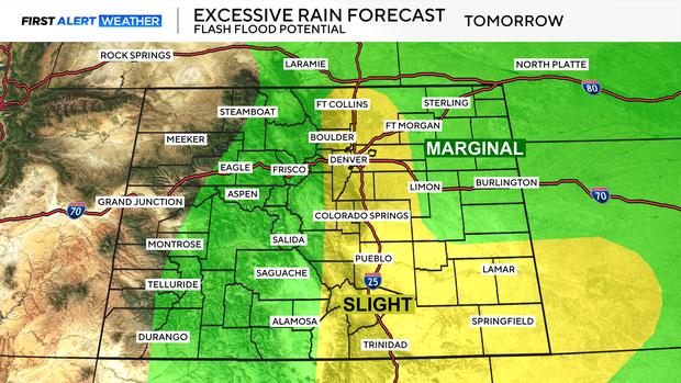
Flash flooding will be possible along the entire I-25 corridor and portions of the eastern plains, especially in flood-prone areas.
Never drive through flooded roads; turn around, don't drown. Just 6 inches of moving water can knock over an adult, and 12 inches can sweep away a car. Flooded roads are often deeper than they appear, and it only takes one misstep to get into serious trouble. If you see water covering the roadway, turn around and find another route.
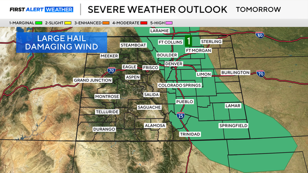
A few storms may also produce large hail and damaging winds. With modest deep-layer shear in place, a few well-organized supercells could form, especially east of the metro, bringing a mix of heavy rain and severe hazards.
Daily rain chances are expected through Friday.