Colorado Weather: Mountain Snow Sunday, Turning Cloudy With A Few Evening Showers In Denver
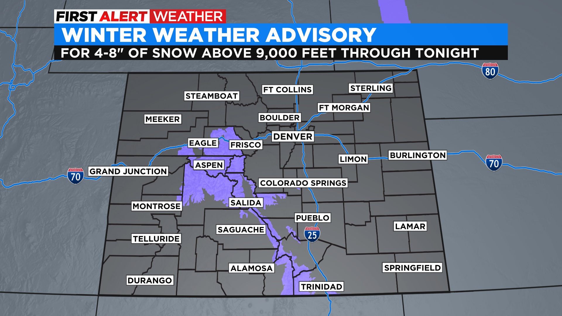
DENVER (CBS4) - A weather system will produce areas of light snow in the mountains on Sunday with some places picking up 4 to 8 inches before the day ends. The National Weather Service has issued a Winter Weather Advisory for parts of the central and south-central mountains. Some in the advisory could even get as much as 10 to 12 inches of additional snow.
In Denver and along the Front Range the clouds will increase throughout the day with mostly cloudy to overcast conditions expected by sunset. There is even a chance for some light rain or snow showers to develop.
Unfortunately, the air has been extremely dry and remains relatively dry at the surface. So while rain showers could form and even show up on the radar, the question will be, can the drops survive the trip out of the cloud and down to the ground. A lot of it will probably evaporate.
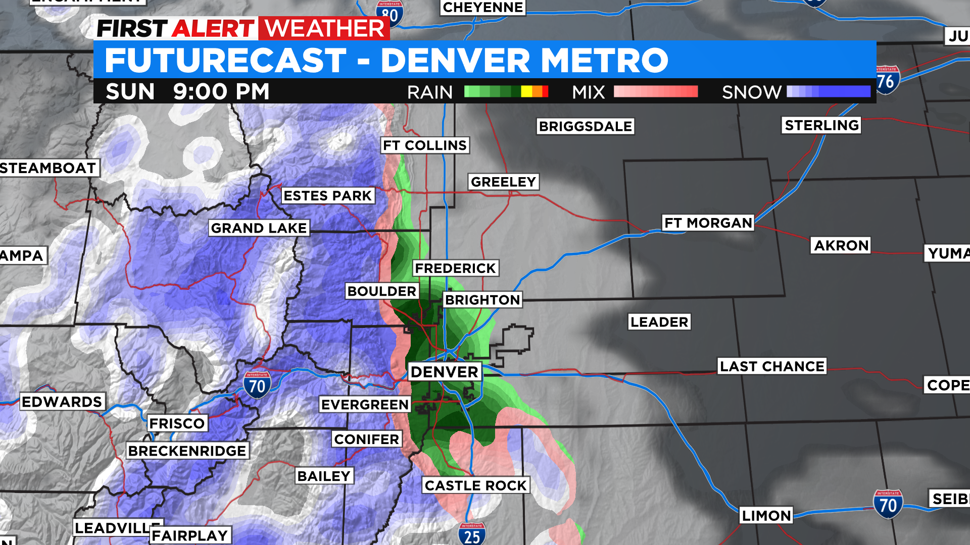
If these showers do form by Sunday evening they could be in the form of snow in the higher elevations west and south of downtown Denver. We're talking about places such as Evergreen, Conifer, Castle Rock and Elizabeth. Totals would be on the light side and the precipitation won't last long. Again, the big wild card here is IF ... showers can form and overcome the very dry air at the surface.
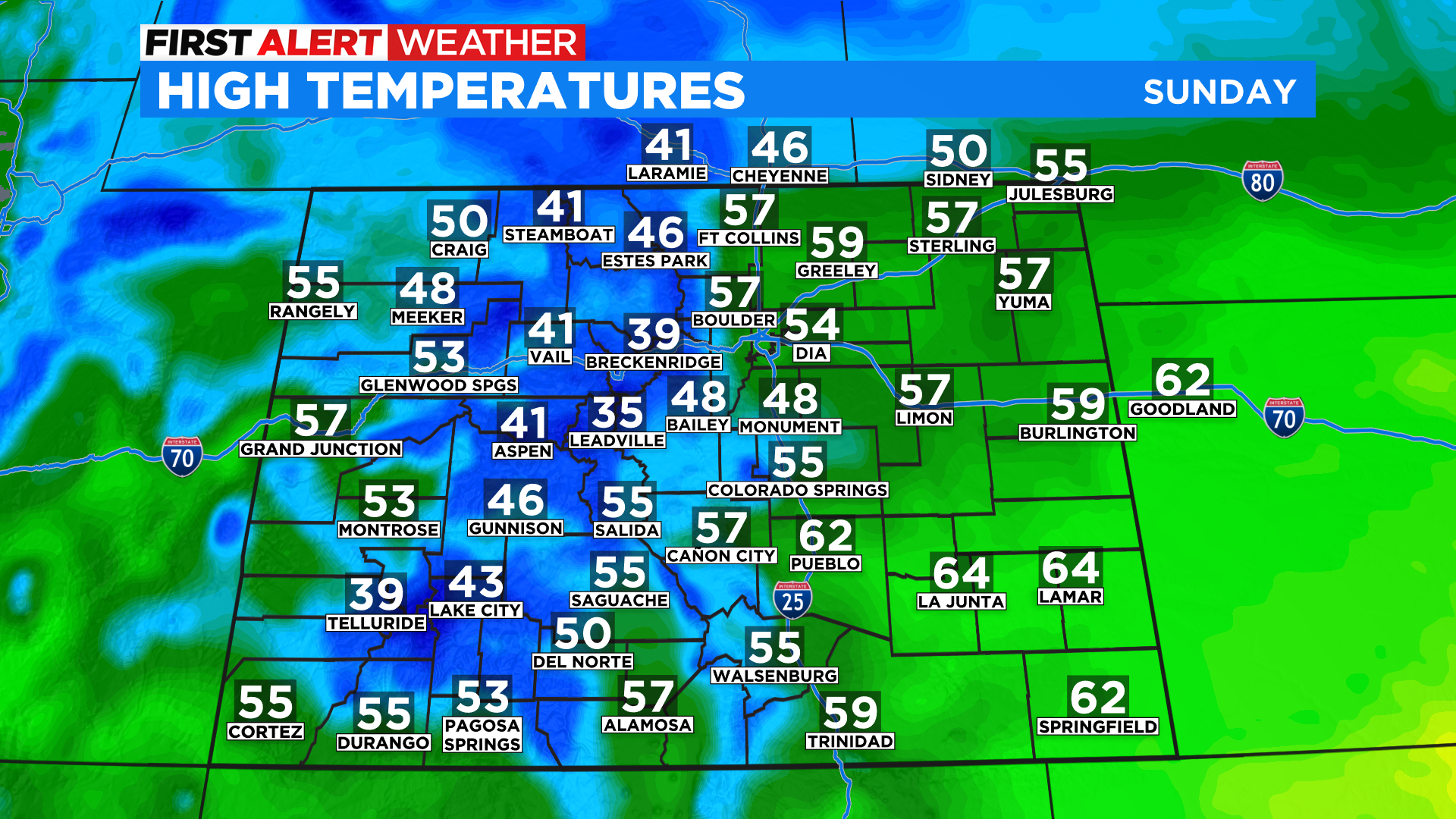
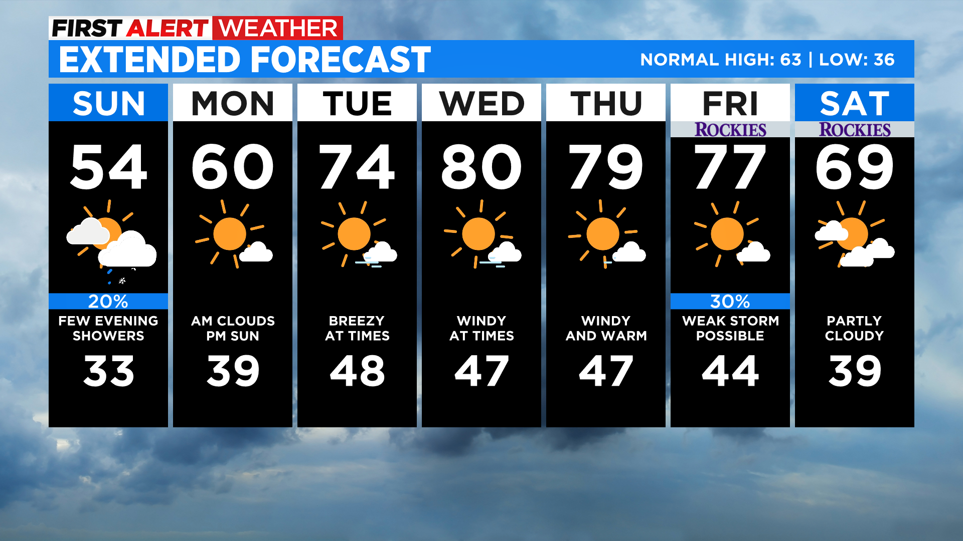
Today will be the coldest day of the week around Colorado with many places running 5 to 10 degrees below normal for this time of the year. In Denver highs will top off in the middle 50s. The trend for the week ahead will be for warmer and drier air to return along with wind and fire danger.