Colder temperatures and a rain/snow mix coming in Denver metro area

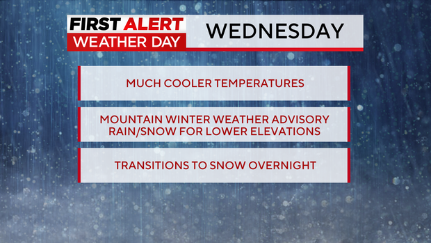
Wednesday's First Alert Weather Day is bringing mountain snow and a wintry mix for the Denver metro area.
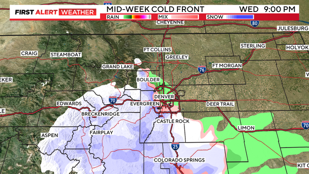
It's quite the mid-week change in our weather pattern in Colorado, as a cold front has pushed in and is bringing snow to the mountains and a rain/snow mix to the Denver metro area and Colorado's Front Range.
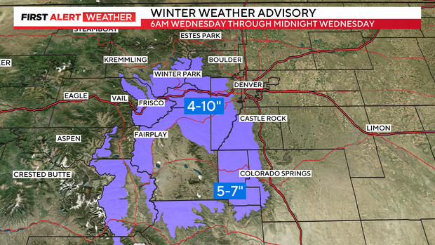
While the Denver metro area won't see much in the way of accumulating snow, the mountains will pile up some accumulating snow with this quick moving system. There is a Winter Weather Advisory in effect through midnight Wednesday for parts of the high country where 4-10" of snow is expected.
The foothills could see 1 to 2 inches of accumulation, but most of the precipitation that will fall for the lower elevations will fall in the form of rain throughout the day Wednesday.

As the day goes on, some of that rain will transition into a wintry mix by the evening, and a few more flurries could fall into the overnight hours. This quick hitting storm system will begin to clear from North to South Thursday.
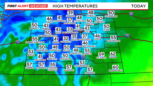
High temperatures on Wednesday afternoon will be roughly 30 degrees cooler than what we have been used to, with most areas only reaching the mid 40s.
By Thursday morning, there could be 1-2" of accumulation into the Palmer Divide, but if anything accumulates for the rest of the Denver area it would be lightly on grassy surfaces.
Behind this system, the sun returns and temperatures head into the upper 50s, low 60s to end the week.