Another round of snow and cold air will arrive this weekend in Denver


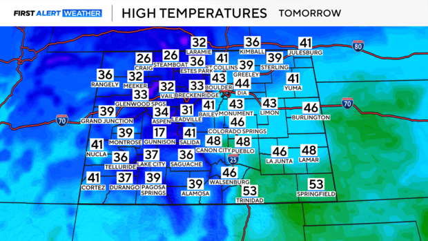
Friday will be the warmest day of the week with daytime highs in the mid-40s for the Denver metro area.
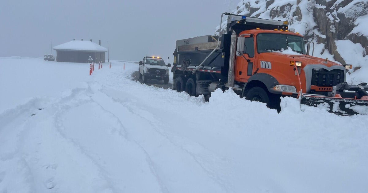
Another round of accumulating snow and colder air is expected to develop across Colorado's mountains, and eventually Denver through the evening on Friday. A First Alert Weather Day has been issued on Saturday for cold and snow.
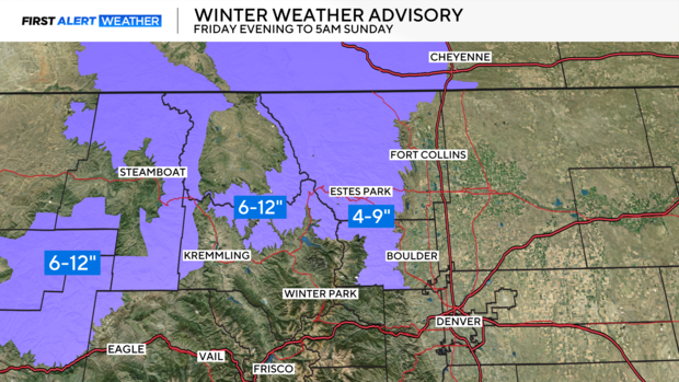
Staring Friday evening a Winter Weather Advisory goes into place through 5 am Sunday for Rabbit Ears Pass, Rocky Mountain National Park and the Medicine Bow Range with 6-12" of accumulation possible. The Northern Front Range Foothills, including Nederland and Estes Park could pick up 4-9" of snowfall.
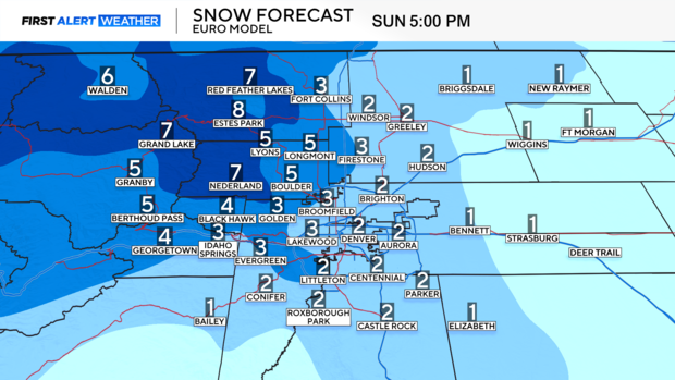
Snow will spread across the foothills and I-25 corridor late Friday into Saturday morning and last through much of the day.
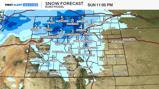
As of now, this is looking like a 1-3"/3-6" for the Denver metro area and foothills. 1-3" is expected across much of the I-25 corridor with lower-end totals around Greeley. 3-6" is expected from Boulder to Evergreen and Conifer, with slightly higher amounts across isolated pockets of the high country. Forecast models show 3-6" of snowfall in the mountains with the northern mountains receiving the brunt of the snow with 6-12" possible.
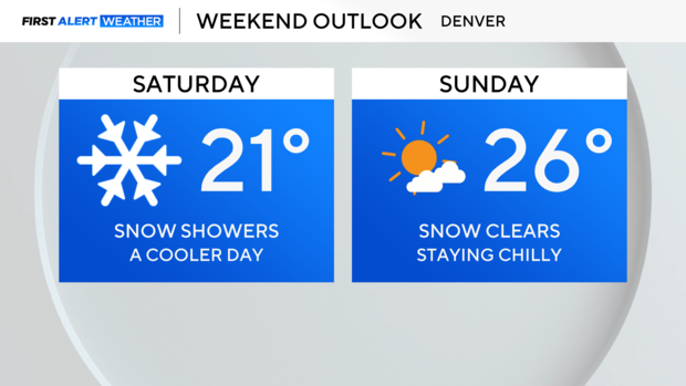
Temperatures will stay below freezing both Saturday and Sunday. Saturday daytime highs will be the low-20s along the urban corridor. Sunday will stay in the mid-20s with gradual clearing throughout the day. Dry weather is expected early next week, with mild daytime highs in the mid-40s by the middle of the week.