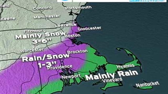
Snow Saturday: What Can We Expect?
So what's the story with the next potential storm on Saturday?
Watch CBS News
So what's the story with the next potential storm on Saturday?

Today will be day #1 of a 2-day break before another coastal low makes it move towards Southern New England. Highs will range from the lower to upper 20s today. Temperatures will reach the lower 30s on Friday.

The situation remains very serious with reports of numerous roof failures and collapses coming in, most of them focused in southeastern Massachusetts, Rhode Island and Connecticut.

The mid-day models are in and show a warmer solution for Wednesday's storm.
We can't seem to catch a break, and for many winter enthusiasts, this is a dream come true. However, I can't help but feel for those who are working hard to keep our roads & sidewalks safe. They are working serious overtime! Today will be the calm before the storm and a quiet end to January.
With a weak trough in place thru the weekend, a couple of 'Alberta Clippers' will dive into the Great Lakes region and try to make their way into Southern New England.
A frigid start to your morning has prompted the issuance of Wind Chill Warnings and Advisories across our entire viewing area. With temperatures only topping off in the upper single digits to the lower teens, wind chill values will hover between -10 and -30 below zero. On a brighter note, the sun will be out in full force.
A few lingering flurries along Coastal Mass. will end this morning allowing for breaks of sun today . Highs will range from the middle 20s to lower 30s.
Clouds will control the sky today while we encounter a few rain/snow showers.
The snow will quickly spread across the entire viewing area throughout the duration of morning rush.
It's going to be a quiet Martin Luther King Jr. Holiday. Sun along with patchy clouds will take us thru the day.
Cold air is seeping southward and bringing us unseasonably cold air for the next couple of days.
The Nor'easter that slammed Southern New England is now off to sea. However, we are left with quite a mess in its aftermath.
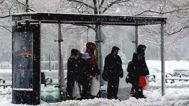
A very powerful nor'easter produced treacherous conditions across all of southern New England Wednesday.
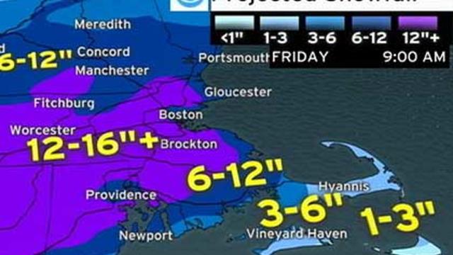
Here we go! Nor'easter 2011 is taking shape and now is nearly a lock for Wednesday.
We are nearly 18 hours away from the largest synoptic-style storm this winter. Sunshine will fade to cloud cover later today as highs range between the upper 20s and lower 30s. Then, the storm makes its move...
It's going to be a cool, yet sunshiny start to the work week.
The first burst of snow will travel from southwest to northeast later today. Although the snow will remain light for the majority of the area, there will be orographic lifting enhancing snowfall across Central and Western Mass..
We will have one more quiet day today with sunshine fading to clouds and highs ranging between 29F-33F.
All is quiet today as increasing sunshine tops our weather headlines.
Calm weather will continue to carry us thru the majority of the first full week of 2011.
Many of you are returning to your first full week of work or school since Christmas or maybe even Thanksgiving.
A tranquil weather pattern is setting up along with a gradual warming trend as we edge our way closer to the end of 2010.
Many of us will be spending the next couple of days cleaning up from the storm. We are going to be granted a string of dry days.
Good morning! Mother nature has been hard-at-work while you were sleeping.