Winter is ending. How accurate was the WBZ winter weather forecast, from snow totals to temperatures?

Meteorological winter is wrapping up, running from December 1 through February 28. Each November the WBZ Weather team gives its outlook for how the upcoming winter season might feel. Some years those forecasts are easier than others.
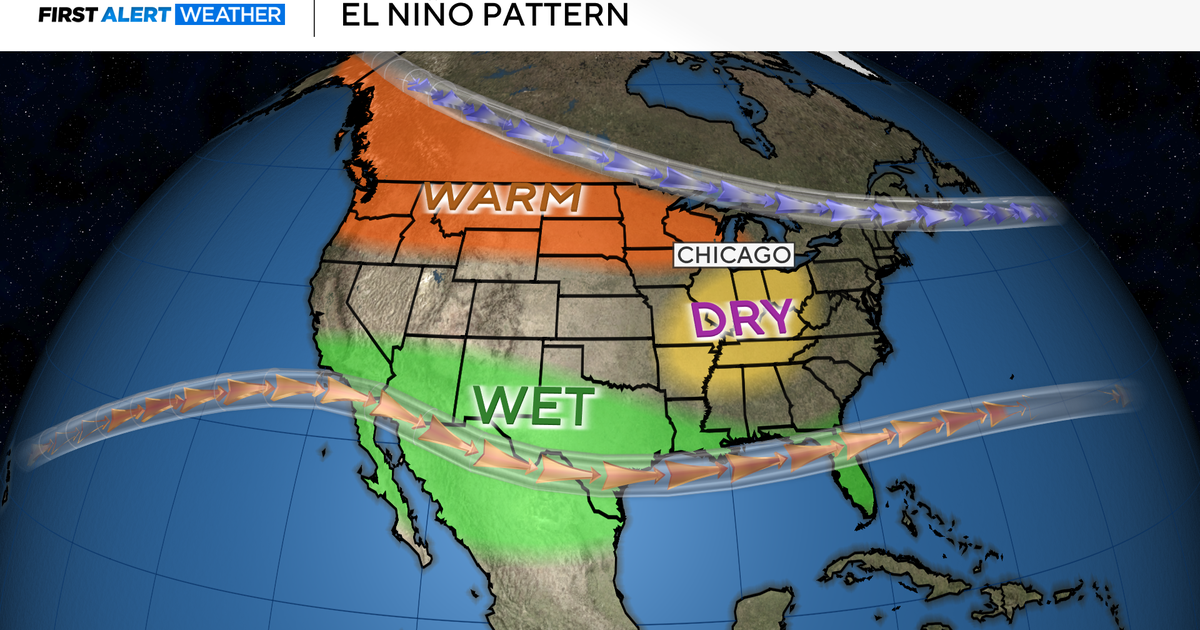
Last winter was straightforward. El Nino dominated and the forecast for a mild and relatively snowless winter was a direct hit.
This winter, the atmospheric signals were more mixed. We knew there would be La Nina conditions. We knew that years with very dry falls and warm Novembers had never led to a snowier than average winter in Boston.
How did it pan out? It's time for our report card.
Less than 30" of snow
We called for less than 30" of snow in Boston this winter. As of right now, that gets a passing grade! Boston is just below that number. Despite the chill this winter, the city still hasn't received a snowfall of 6" or greater in over three years. Central Massachusetts is even farther below average.
Boston has 28.1" of snow to date. Last time Boston had a 6"+ snowstorm was Feb. 25, 2022.
Next, we forecasted that the majority of the snow and cold would come after MLK Day. That worked out well. About 75% of the snow occurred on or after MLK Weekend and our coldest temperatures compared to averages have indeed come in the tail end of winter.
Coldest winter since 2014-2015
Lastly, we forecast a milder than average season overall. That one gets a fail. It was the first colder than average winter in a decade. There were no records set, but the cold was nothing if not persistent. We went 55 days before we hit 50 degrees just a few days ago. Although we didn't get a lot of snow, it was a much better season for ice.
This was the coldest winter since 2014-2015.
After a couple of dud winters, I think the last few months proved that a good old fashion winter is still possible in New England.