Light snow is in the weekend forecast for Massachusetts. Storms next week could bring ice, rain and more snow.
BOSTON - It's been quite chilly in Massachusetts these past few days. The temperatures are expected to get warmer, but it's nothing to be too happy about with a weekend dusting of snow on the way.
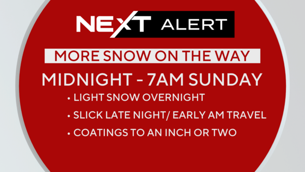
The WBZ Weather team is issuing a Next Weather Alert for the light snowfall. This will be a quick and relatively light snow event, but something we want to make you aware of as you make your weekend plans.
Weather expected to get slightly warmer
We are in the midst of the coldest 24-hour period of the season thus far. If you stepped outside today, you know. The winds are howling and making it feel like single digits and teens.
It will be a slow climb out of the freezer in the next 24 to 48 hours.
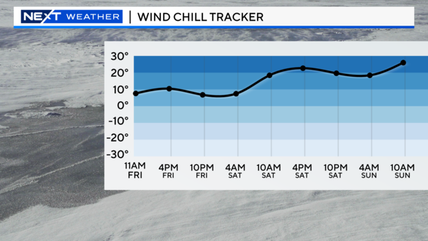
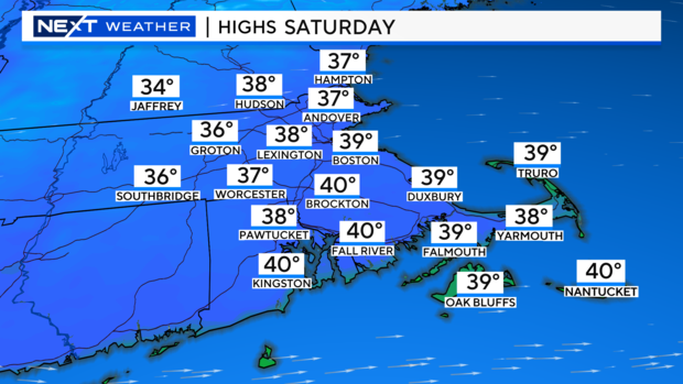
The winds will slacken a bit by Saturday, but will still be quite busy. At least the high temperatures will start to inch in the right direction.
Dusting of snow this weekend
Remember that sunny, dry, quiet stretch we had going? Those days are long gone. There are several chances of rain, snow and ice coming up in the next week.
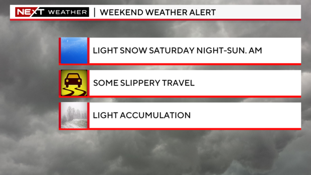
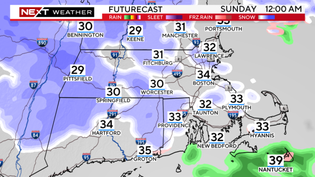
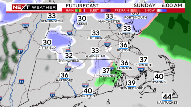
Of immediate concern, there is likely to be some light snow Saturday night through early Sunday, mainly between 10 p.m. and 7 a.m. It will come in from the west Saturday night, arriving in western and central Mass. between 9 to 11 p.m. and will arrive in eastern Mass. between 11 p.m. and 1 a.m.
It will be light and somewhat spotty in southern New England, but it could be enough to whiten roads and cause some slippery travel overnight.
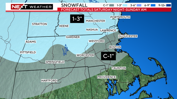
Accumulations will be light, mainly scattered coatings throughout the area. We generally expect a coating to an inch of snow for most of the area south of 495 and Route 2.
We are forecasting one to three inches of snow closer to the Massachusetts and New Hampshire border and all areas northward. This would include northernmost Essex, Middlesex, and Worcester counties.
It will be a quick mover, tapering off between 7 to 10 a.m. Sunday morning for most, if not all, of southern New England.
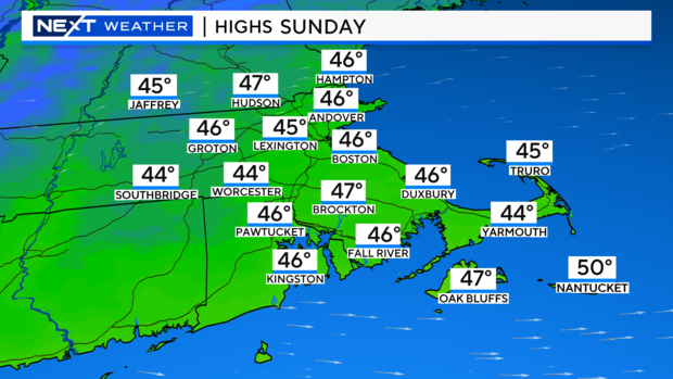
And temperatures will finally get back to around normal!
Messy weather next week
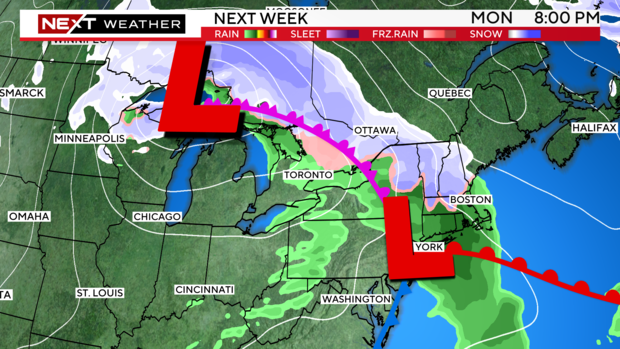
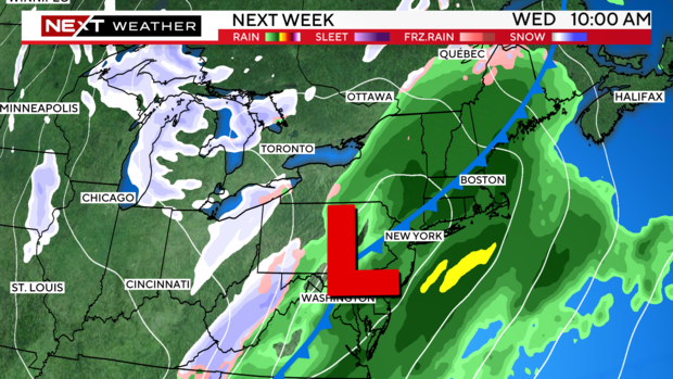
Looking ahead to next week, it looks very active and potentially messy. There is a chance for some precipitation just about every day.
Round one arrives late Monday and could feature a mix of rain, ice, and snow. We will have much more on this storm in the coming days.
One final note. Over the next few days, we will experience the earliest sunsets of the year, and then next week, we will start going the other way! Despite this, the shortest day of the year isn't for another few weeks, on the winter solstice.