Will a nor'easter bring more snow to Massachusetts this weekend? Here's what the weather forecast says.
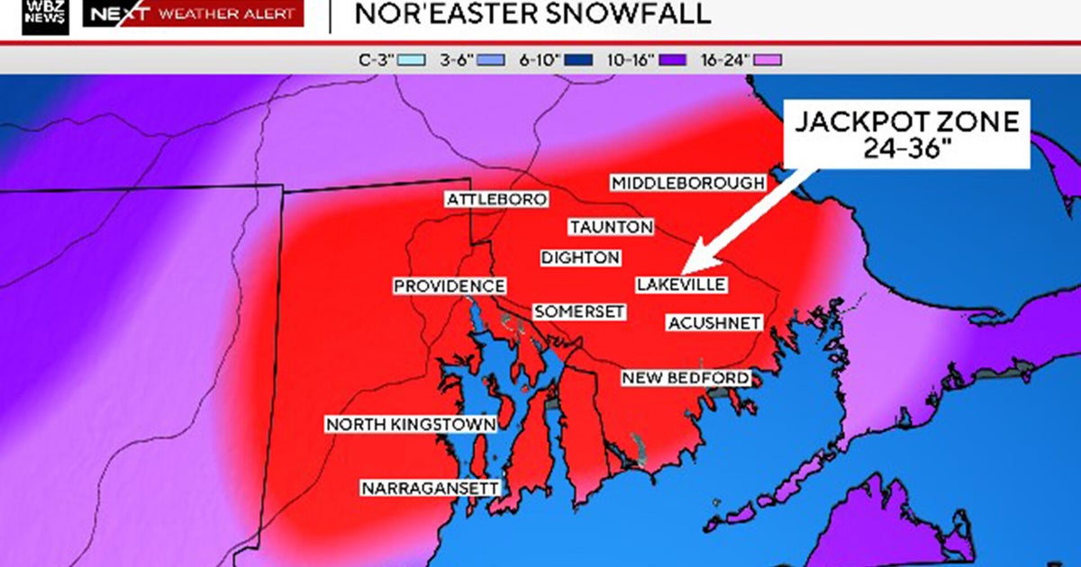
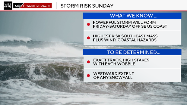
Update 1/29: The storm's eastward trend continues, and southeastern Massachusetts, Cape Cod and the Islands are at the greatest risk.
After another record setting, top-ten snowstorm for Boston, it's hard to ignore what may be coming next for Massachusetts. We are now less than four days from any potential impacts from a nor'easter and our forecast confidence is increasing.
Today, we are narrowing down the scenarios and focusing in on a track that would clip southern New England.
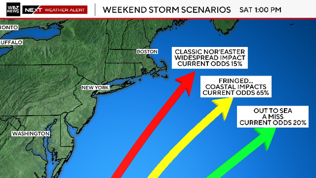
Massachusetts storm scenarios
We are lowering the "odds" on a worst-case scenario to about 15%. This scenario brings the track of the storm close to 40N 70W, the "benchmark" for classic New England nor'easters and would lead to widespread, high-end impacts for our entire area.
We also have lowered the odds of a complete miss to about 20%. Given the size and magnitude of the storm as it passes our latitude, it seems unlikely that we wouldn't feel some impacts. Even with a storm track several hundred miles out to sea, the northwestern fringe could still clip us with significant wind and snow.
That brings us to what has become the most likely track - outside the benchmark but not completely out to sea.
The rest of this blog will focus on what impacts that may bring to southern New England.
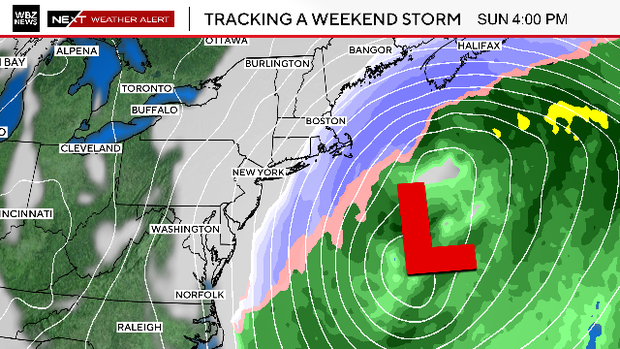
"Bombogenesis" expected
The storm is going to be massive. We expect it to undergo bombogenesis Saturday afternoon through Sunday afternoon. The central pressure will plummet, creating an extremely powerful storm system.
There will likely be a sharp cutoff between significant impacts from wind and snow and very minor impacts.
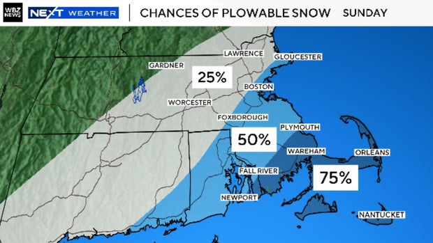
Where will the storm hit hardest?
The closer you live to the storm, the higher your risk. So, that big section of the state that juts out into the ocean (otherwise known as Cape Cod), carries the highest risk.
The farther north and west you live, away from the storm, the lower your risk.
Granted, it is early for snow totals, but the probabilities of something significant and plowable raise significantly to the south and east.
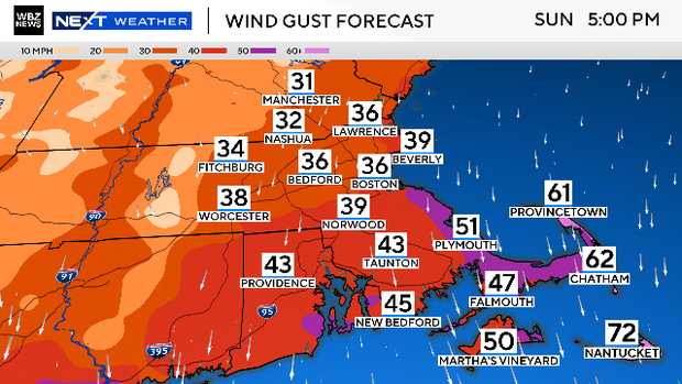
Wind gusts expected
The same can be said with the wind gusts. We could see northerly gusts 50-60 mph or higher over the South Shore, Cape and Islands.
At the same time, there would be a much "tamer" wind profile inland. Still gusty, but not nearly as impactful or damaging. The peak gusts will occur Sunday midday through early Monday morning.
Flooding concerns
The wave heights over the open Atlantic Ocean look more like something you would see during a hurricane passage.
There will be large waves and swells along the entire stretch from New England to the Carolinas.
Given that we are facing high astronomical tides this weekend, there is extra, added concern for coastal flooding, particularly at north or north-northeast facing beaches.
It won't take much of a storm surge to cause moderate to high levels of flooding.
Our WBZ NEXT Weather Team has you covered. We will provide frequent updates all week on WBZ-TV and WBZ.com. When we know, you know.