Few Friday Showers; Near Record Warmth To Kick Off February
We've made it to the end of the week! It'll be nice to have a quiet weekend weather wise after last weekend's blizzard and soaking rain the weekend prior to that. Now we've been talking about some unsettled weather for today all week along…so let's break down what to expect for your Friday.
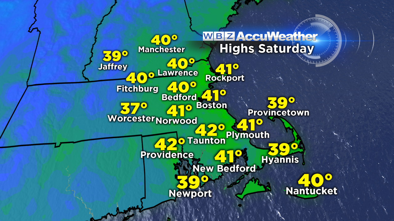
A large ocean storm will stay out to sea, combining and interacting too late with a disturbance from the west to create any big weather headaches here in southern New England. We will see a few flurries and sprinkles later this morning into the afternoon, with a brief rain or snow shower during the evening commute. The impact will be limited to a scattered coating on grassy surfaces across the far interior. In other words, this is no biggie...I just don't want you to be caught off guard if you see some flakes flying later on today.
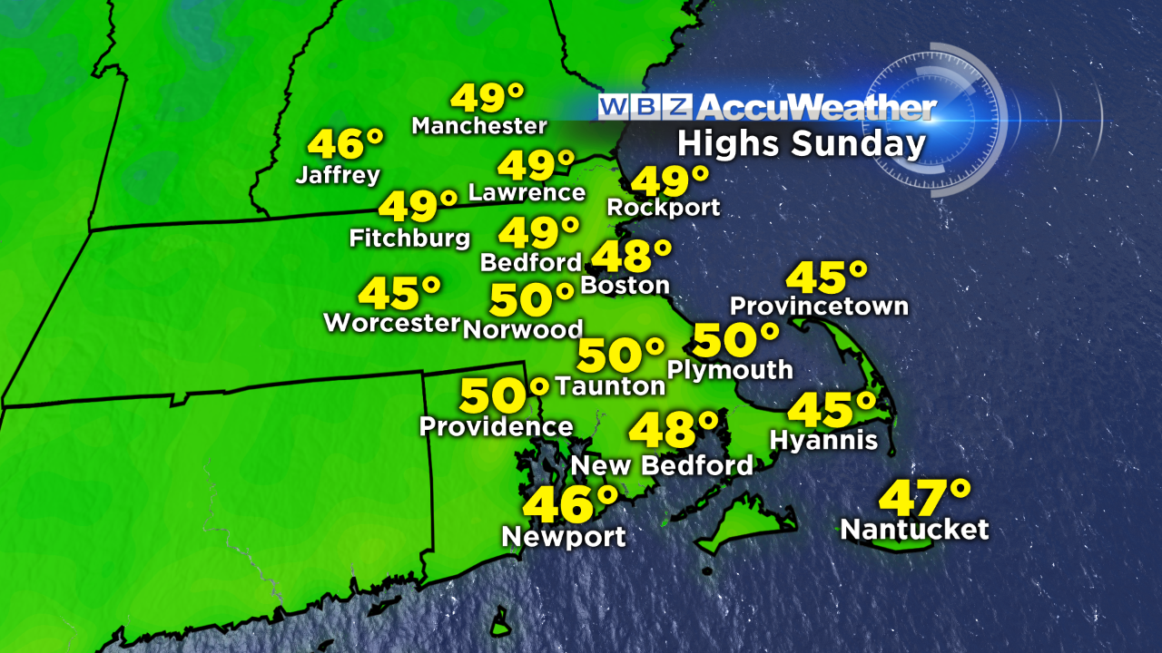
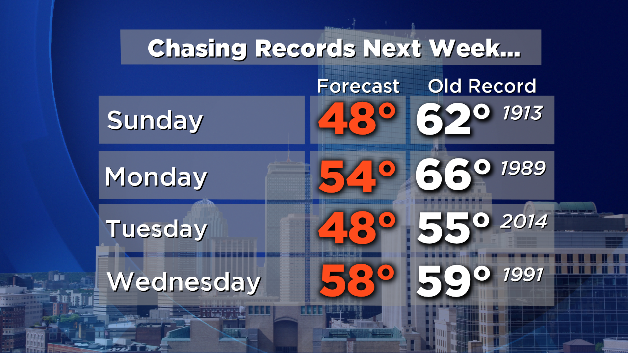
Skies will clear overnight and we'll have sunshine to greet us tomorrow morning. Clouds will advance in tomorrow afternoon filtering that sun a bit as a warm front approaches from the west. That front sparks scattered snow showers in northern New England tomorrow and ushers in milder air for Sunday. Some communities will likely touch 50 Sunday afternoon!
And that's just the start. Even warmer air pushes into the region on Monday. It'll feel more like mid-April than the first day of February! Our next storm arrives on Wednesday, bringing with it areas of rain...and near record warmth for midweek.
So if you don't like the cold and snow, this stretch is for you. Winter lovers, don't worry…there's still plenty of time to squeeze out some storms – in fact, it looks like colder air returns by the end of next week through at least the middle of February.
-Danielle